Area Overview for L30 0RG
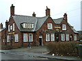
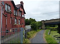
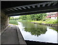
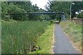
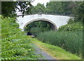
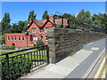
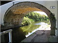
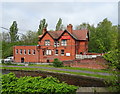
Photos of L30 0RG


Area Information
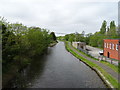
Living in L30 0RG means being part of a compact, densely populated residential cluster in England. The area covers just 3.4 hectares, yet it accommodates 1,176 residents, resulting in a population density of 34,974 people per square kilometre. This high density suggests a tightly knit community, though the small size may limit private space. The area’s character is defined by its proximity to transport links and retail hubs, with nearby stations and ferry terminals offering connectivity to larger urban centres. While the postcode is small, it sits within a region with notable infrastructure, including major rail routes and ports. For those seeking a balance between urban accessibility and a residential setting, L30 0RG offers a microcosm of compact living, though its limited size means residents must navigate shared spaces and community dynamics closely. The area’s appeal lies in its practicality, with essential services within reach, but its constraints are evident in its spatial limitations.
- Area Type
- Postcode
- Area Size
- 3.4 hectares
- Population
- 1176
- Population Density
- 4710 people/km²
The property market in L30 0RG is shaped by its small size and high population density. With 42% of homes owned by residents, the area features a mix of owner-occupied properties and rental units. The accommodation type is predominantly houses, which may suggest a focus on family homes or single-dwelling units. Given the area’s compact nature, the housing stock is likely limited, potentially driving competition among buyers. The high population density—34,974 people per square kilometre—implies that properties are closely spaced, which could affect privacy and outdoor space. For buyers, this means a small pool of available homes, with a strong emphasis on houses rather than apartments. The immediate surroundings may offer more options, but within L30 0RG itself, the market is likely tight. Prospective buyers should consider the area’s spatial constraints and the predominance of single-family homes when evaluating opportunities.
House Prices in L30 0RG
No properties found in this postcode.
Energy Efficiency in L30 0RG
Residents of L30 0RG have access to a range of nearby amenities, including retail outlets such as Heron Netherton, Iceland Netherton, and Tesco Thornton. These shops provide essential grocery and retail services, reducing the need for long trips. The area’s proximity to rail stations like Old Roan and Aintree, along with ferry terminals such as Liverpool Belfast and Seacombe, ensures connectivity to larger urban centres and coastal routes. While the area itself is small, the surrounding infrastructure offers opportunities for leisure, dining, and commuting. The presence of multiple transport options suggests a lifestyle that balances local convenience with access to broader networks. However, the limited size of L30 0RG means that parks or recreational spaces are not explicitly mentioned in the data, which could be a consideration for those prioritising green spaces. Overall, the area supports a practical, service-oriented daily life.
Amenities
Schools
| Rank | School | Type | Entry gender | Ages |
|---|
Explore more schools in this area
Go to Schools tabDemographics
The community in L30 0RG is predominantly middle-aged, with a median age of 47 and the most common age range being adults aged 30–64. This suggests a population skewed towards families and professionals in their prime earning years. Home ownership rates stand at 42%, indicating a mix of owner-occupied properties and rental units. The accommodation type is primarily houses, which may reflect a preference for standalone living over flats or apartments. The predominant ethnic group is White, though no specific data on diversity or deprivation levels is provided. The high population density—34,974 people per square kilometre—raises questions about living conditions, though no explicit data on overcrowding or housing quality is available. For those considering L30 0RG, the demographic profile hints at a stable, family-oriented environment, though the lack of detailed diversity metrics leaves some aspects of the community’s composition unexplored.
Household Size
Accommodation Type
Tenure
Ethnic Group
Religion
Household Composition
Age
Household Deprivation
NS-SEC
Explore more demographic insights in this area
Go to Demographics tabPlanning
Planning Constraints
- Flood RiskPremium
- Ramsar Wetland SitesPremium
- Area of Outstanding Natural BeautyPremium
- Protected Nature ReservePremium
- Protected WoodlandPremium