Area Overview for L29 1YB
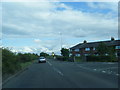
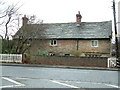
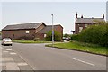
Photos of L29 1YB


Area Information
Living in L29 1YB means inhabiting a compact, residential postcode area in England, spanning 23 hectares and home to 1,620 residents. This small cluster of homes is defined by its modest size and low population density of 228 people per square kilometre, offering a quiet, low-rise environment. The area’s character is shaped by its mature demographic, with a median age of 47 and most residents falling within the 30-64 age range. Daily life here is marked by a balance of stability and practicality, with homes predominantly owner-occupied (75%) and focused on single-family dwellings. Proximity to retail hubs like Tesco Thornton and nearby rail stations such as Aintree Railway Station ensures accessibility to essential services without the congestion of larger urban centres. While the area lacks natural or protected landscapes, its straightforward layout and proximity to ferry terminals like Liverpool Belfast Ferry Terminal Bootle make it a viable option for those prioritising connectivity over scenic surroundings.
- Area Type
- Postcode
- Area Size
- 23.0 hectares
- Population
- 1620
- Population Density
- 228 people/km²
The property market in L29 1YB is characterised by a high rate of home ownership (75%), with houses forming the predominant type of accommodation. This suggests a market where long-term residency is the norm, rather than short-term rental activity. The small area size (23 hectares) means the housing stock is limited, potentially making the local market competitive for buyers seeking properties in this specific postcode. Given the focus on owner-occupied homes, the area is unlikely to be a hotspot for rental demand, though proximity to rail and ferry services may attract commuters. Buyers should consider the area’s compact nature and its integration with nearby amenities like Tesco Thornton and Aintree Railway Station, which enhance its practical appeal. The absence of protected or constrained land means development restrictions are minimal, though the small footprint may limit expansion.
House Prices in L29 1YB
Showing 2 properties
| Address | Type | Beds | Baths | Last Sale Price | Last Sale Date | |
|---|---|---|---|---|---|---|
| Orchard Farm, Buckley Hill Lane, Sefton, L29 1YB | Cottage | 4 | - | £210,000 | Jul 2018 | |
| Shy Lowen Horse And Pony Sanctuary, Buckley Hill Lane, Sefton, L29 1YB | commercial | - | - | - | - |
Energy Efficiency in L29 1YB
Daily life in L29 1YB is supported by a range of nearby amenities within practical reach. Retail options include Heron Netherton, Iceland Netherton, and Tesco Thornton, catering to everyday shopping needs. The area’s rail network, with stations such as Aintree and Seaforth & Litherland, provides easy access to broader regional services, while ferry terminals like Seacombe and Liverpool Isle of Man & Dublin Terminal offer alternative transport routes. Though the area itself is small, its proximity to these facilities ensures residents are not isolated from essential services. The presence of multiple retail and transport hubs contributes to a functional lifestyle, balancing convenience with the quietude of a low-density postcode. For those valuing accessibility without urban sprawl, L29 1YB offers a pragmatic mix of local and regional connectivity.
Amenities
Schools
| Rank | School | Type | Entry gender | Ages |
|---|
Explore more schools in this area
Go to Schools tabDemographics
The community in L29 1YB is predominantly composed of adults aged 30-64, reflecting a median age of 47. This suggests a population skewed towards middle-aged individuals, likely with established careers and families. Home ownership is high, with 75% of residents owning their homes, indicating a stable, long-term presence in the area. The accommodation type is primarily houses, aligning with the demographic’s preference for private, family-oriented living. Ethnically, the area is predominantly White, with no specific data provided on other groups. The population density of 228 people per square kilometre is relatively low, contributing to a less crowded environment. While no deprivation data is cited, the combination of high home ownership and mature age profile implies a community focused on comfort and continuity rather than rapid change.
Household Size
Accommodation Type
Tenure
Ethnic Group
Religion
Household Composition
Age
Household Deprivation
NS-SEC
Explore more demographic insights in this area
Go to Demographics tabPlanning
Planning Constraints
- Flood RiskPremium
- Ramsar Wetland SitesPremium
- Area of Outstanding Natural BeautyPremium
- Protected Nature ReservePremium
- Protected WoodlandPremium