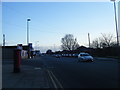
Area Overview for L3 4BL
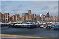
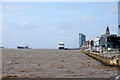
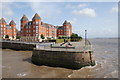
Photos of L3 4BL


Area Information
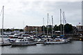
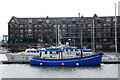
Living in L3 4BL means inhabiting a tightly packed residential cluster in England, where 1,205 people reside across just 2.7 hectares. The area’s high population density—45,386 people per square kilometre—creates a compact, densely populated environment. This postcode is defined by its proximity to essential services and transport links, making it practical for daily life. Residents benefit from nearby schools, retail outlets, and multiple railway stations, including Brunswick and St Michaels. The area’s small size means amenities are within walking distance, though the high density may influence community dynamics. With a median age of 47 and a population skewed toward adults aged 30–64, L3 4BL is a mature, stable neighbourhood. Its mix of flats and low home ownership suggests a rental-focused market, catering to professionals and families seeking convenience over spacious living. The area’s compact footprint and central connectivity make it a practical choice for those prioritising accessibility over expansive space.
- Area Type
- Postcode
- Area Size
- 2.7 hectares
- Population
- 1205
- Population Density
- 2496 people/km²
The property market in L3 4BL is characterised by a low home ownership rate of 34%, suggesting that most residents rent rather than own their homes. The accommodation type is predominantly flats, reflecting the area’s small size and high population density. This makes L3 4BL a rental-focused market, likely catering to professionals and families seeking affordable, centrally located housing. The limited space means property availability is constrained, and the small area’s immediate surroundings may offer few alternatives. Buyers considering the area should note the dominance of flats and the lack of larger properties, which may limit options for those seeking more space. The compact nature of the postcode also means that property values are likely influenced by proximity to transport and amenities, rather than land size. For those prioritising convenience over home ownership, L3 4BL offers a practical, if limited, housing stock.
House Prices in L3 4BL
Showing 12 properties
| Address | Type | Beds | Baths | Last Sale Price | Last Sale Date | |
|---|---|---|---|---|---|---|
| Mersey Internal Audit Agency, Regatta Place, Summers Road, Liverpool, L3 4BL | Office | - | - | - | - | |
| Mersey Deanery, Regatta Place, Summers Road, Liverpool, L3 4BL | shop | - | - | - | - | |
| 205, Century Building, Tower Street, Liverpool, L3 4BL | storage_distribution | - | - | - | - | |
| 9, Century Building, Tower Street, Liverpool, L3 4BL | shop | - | - | - | - | |
| 301 Summers Road, Liverpool, L3 4BL | Office | - | - | - | - | |
| 18 Summers Road, Liverpool, L3 4BL | assembly_leisure | - | - | - | - | |
| 309 Summers Road, Liverpool, L3 4BL | Industrial | - | - | - | - | |
| 303 Summers Road, Liverpool, L3 4BL | Industrial | - | - | - | - | |
| 307 Summers Road, Liverpool, L3 4BL | Industrial | - | - | - | - | |
| 305 Summers Road, Liverpool, L3 4BL | shop | - | - | - | - |
Energy Efficiency in L3 4BL
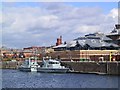
Daily life in L3 4BL is shaped by its proximity to a range of amenities. Residents can access retail outlets like Spar, Tesco Park, and Lidl Park for groceries and essentials, while ferry terminals such as Woodside Birkenhead and Liverpool Pier Head offer transport to nearby towns and islands. The area’s railway stations, including Brunswick and St Michaels, provide easy access to the Liverpool Central Loop Line, facilitating travel to the city centre and beyond. The nearby Liverpool John Lennon Airport adds further connectivity for those needing flights. While the data does not mention parks or leisure facilities directly, the presence of multiple transport and retail hubs suggests a focus on convenience over expansive recreational spaces. This makes L3 4BL ideal for those prioritising accessibility and practicality in their daily routines.
Amenities
Schools
The nearest school to L3 4BL is MGL Academy, an independent institution. This type of school typically requires fees and may cater to specific educational philosophies or specialisms. The absence of state schools in the data suggests that families in the area may need to look beyond the immediate postcode for public education options. The presence of a single independent school highlights a potential focus on private education in the community, though it does not indicate the quality or Ofsted rating of the institution. For families prioritising independent schooling, MGL Academy provides a nearby option, but those seeking state-funded education will need to consider neighbouring areas. The limited school data reflects the small size of the postcode and its concentration on residential rather than educational infrastructure.
| Rank | School | Type | Entry gender | Ages |
|---|
Explore more schools in this area
Go to Schools tabDemographics
The community in L3 4BL is predominantly composed of adults aged 30–64, with a median age of 47. This suggests a mature population, likely comprising professionals, families, and long-term residents. Home ownership is relatively low at 34%, indicating a rental market that dominates the area. The accommodation type is predominantly flats, reflecting the small footprint of the postcode and the need for high-density living. The predominant ethnic group is White, with no data provided on other demographics. The high population density—45,386 people per square kilometre—means the area is intensely populated, which can influence local services and social interactions. While this density offers proximity to amenities, it may also contribute to a sense of overcrowding. The lack of specific data on deprivation or diversity limits deeper analysis, but the figures highlight a community shaped by practicality and proximity to infrastructure.
Household Size
Accommodation Type
Tenure
Ethnic Group
Religion
Household Composition
Age
Household Deprivation
NS-SEC
Explore more demographic insights in this area
Go to Demographics tabPlanning
Planning Constraints
- Flood RiskPremium
- Ramsar Wetland SitesPremium
- Area of Outstanding Natural BeautyPremium
- Protected Nature ReservePremium
- Protected WoodlandPremium