Area Overview for L3 4BE
Photos of L3 4BE


Area Information
Living in L3 4BE means inhabiting a compact, densely populated postcode area of just 2.4 hectares, home to 1,205 residents. This small cluster of homes sits at the heart of a tightly woven community, where proximity to amenities and transport links defines daily life. The area’s high population density—50,413 people per square kilometre—reflects its role as a residential hub within a broader urban context. Residents benefit from nearby rail networks, ferry terminals, and retail hubs, creating a lifestyle that balances convenience with the constraints of limited space. The area’s demographic profile, with a median age of 47 and a majority of adults aged 30–64, suggests a mature, stable community. While the postcode lacks natural or protected landscapes, its strategic location near Liverpool’s transport arteries and commercial zones makes it appealing for those prioritising connectivity over open space. However, buyers should consider the area’s flood risk and average crime levels when evaluating long-term suitability.
- Area Type
- Postcode
- Area Size
- 2.4 hectares
- Population
- 1205
- Population Density
- 2496 people/km²
The property market in L3 4BE is characterised by a low home ownership rate of 34%, suggesting that the area is largely occupied by renters rather than owner-occupiers. The predominant accommodation type is flats, which aligns with the postcode’s small size and high density. This configuration implies limited scope for large homes or detached properties, making the area more suitable for those seeking compact, centrally located living. For buyers, the small footprint of L3 4BE means that property options are constrained, though proximity to transport and amenities may offset the lack of space. The market likely reflects a balance between rental demand and limited supply, with prices potentially influenced by the area’s strategic connectivity to Liverpool’s rail, ferry, and retail networks.
House Prices in L3 4BE
Showing 1 properties
| Address | Type | Beds | Baths | Last Sale Price | Last Sale Date | |
|---|---|---|---|---|---|---|
| 14 Atlantic Way, Brunswick Business Park, Liverpool, L3 4BE | warehouse | - | - | - | - |
Energy Efficiency in L3 4BE
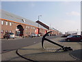
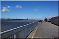
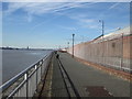
Life in L3 4BE is defined by proximity to essential amenities. Residents have access to five retail outlets, including Spar, Tesco Park, and Lidl Park, providing convenience for daily shopping. The area’s rail network, with stations like Brunswick and St Michaels, connects to Liverpool’s transport arteries, while ferry terminals such as Woodside Birkenhead and Liverpool Pier Head offer links to nearby towns and islands. The presence of Liverpool John Lennon Airport adds to the area’s accessibility. Though the postcode itself is small, its strategic location ensures residents can easily reach larger urban centres. The compact nature of L3 4BE means that amenities are tightly clustered, creating a lifestyle where convenience often outweighs space, though the limited area may feel restrictive for those accustomed to more expansive living.
Amenities
Schools
The nearest school to L3 4BE is MGL Academy, an independent institution. While no Ofsted rating is provided, the presence of an independent school suggests a focus on private education for families in the area. However, the data does not list any state schools, which may require residents to seek options beyond the immediate vicinity. For parents prioritising independent education, MGL Academy offers a structured learning environment, though its fees and admission criteria are not specified. The absence of state schools nearby means that families may need to consider commuting to other parts of Liverpool for public education, which could impact daily routines and costs.
| Rank | School | Type | Entry gender | Ages |
|---|
Explore more schools in this area
Go to Schools tabDemographics
The community in L3 4BE is predominantly composed of adults aged 30–64, with a median age of 47. This suggests a mature population, likely with established careers and families. Home ownership is relatively low at 34%, indicating that the area is more rental-focused than owner-occupied. The accommodation type is primarily flats, reflecting the compact nature of the postcode. The predominant ethnic group is White, though specific data on diversity or deprivation is not provided. The high population density—over 50,000 people per square kilometre—implies a mix of household types, possibly including multi-generational or shared living arrangements. For buyers, this density may translate to a tight-knit but potentially transient community, where proximity to services is a key draw but space is at a premium.
Household Size
Accommodation Type
Tenure
Ethnic Group
Religion
Household Composition
Age
Household Deprivation
NS-SEC
Explore more demographic insights in this area
Go to Demographics tabPlanning
Planning Constraints
- Flood RiskPremium
- Ramsar Wetland SitesPremium
- Area of Outstanding Natural BeautyPremium
- Protected Nature ReservePremium
- Protected WoodlandPremium