Area Overview for L3 2AP
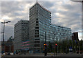
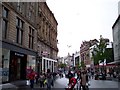
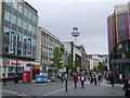
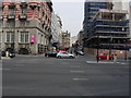
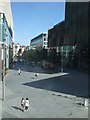
Photos of L3 2AP


Area Information
Living in L3 2AP means inhabiting a compact, densely populated residential area in England. With a population of 3,677 spread across 5,739 square metres, this postcode is one of the most densely populated in the country, at 640,731 people per square kilometre. The area’s small size and high density create a tightly knit community, though it lacks the sprawling character of larger urban districts. L3 2AP is a young area, with the median age at 22 and most residents falling within the 15–29 age range. This demographic suggests a focus on student or early-career populations, likely linked to nearby educational institutions. The area’s proximity to transport hubs, including multiple railway stations and ferry terminals, positions it as a convenient base for commuters. However, its small footprint means amenities and services are concentrated, requiring residents to navigate a mix of local shops and broader city networks for daily needs.
- Area Type
- Postcode
- Area Size
- 5739 m²
- Population
- 3677
- Population Density
- 21965 people/km²
The property market in L3 2AP is almost entirely rental-based, with just 11% of residents owning their homes. Flats dominate the housing stock, reflecting the area’s high population density and limited space for larger properties. This suggests a focus on affordability and efficiency, catering to students or young professionals seeking short-term accommodation. The small size of the postcode means the housing stock is finite, with little scope for expansion. Buyers considering the area should note the scarcity of owner-occupied homes, which may indicate limited opportunities for long-term investment. The prevalence of flats also means property values are likely influenced by proximity to transport links and local amenities, rather than traditional factors like garden space or home size. Prospective buyers should approach the market with realistic expectations, given the area’s compact nature and rental-centric profile.
House Prices in L3 2AP
Showing 67 properties
| Address | Type | Beds | Baths | Last Sale Price | Last Sale Date | |
|---|---|---|---|---|---|---|
| 37 Great Crosshall Street, Liverpool, L3 2AP | Flat | - | - | £22,100 | Jul 2005 | |
| Apartment 12, 57 Great Crosshall Street, Liverpool, L3 2AP | Flat | 1 | 1 | - | - | |
| Apartment 21, 57 Great Crosshall Street, Liverpool, L3 2AP | Flat | 1 | 1 | - | - | |
| 33 Great Crosshall Street, Liverpool, L3 2AP | Retail | 2 | 1 | - | - | |
| 39 Great Crosshall Street, Liverpool, L3 2AP | Flat | 1 | 1 | - | - | |
| Apartment 40, 57 Great Crosshall Street, Liverpool, L3 2AP | Flat | - | - | - | - | |
| Apartment 14, 57 Great Crosshall Street, Liverpool, L3 2AP | Flat | - | - | - | - | |
| Apartment 20, 57 Great Crosshall Street, Liverpool, L3 2AP | Flat | - | - | - | - | |
| Apartment 27, 57 Great Crosshall Street, Liverpool, L3 2AP | Flat | - | - | - | - | |
| Apartment 48, 57 Great Crosshall Street, Liverpool, L3 2AP | Flat | - | - | - | - |
Energy Efficiency in L3 2AP
Life in L3 2AP is defined by its proximity to retail, transport, and urban amenities. Within walking distance are shops like Tesco Liverpool and Co-op University of, providing essential grocery and convenience services. The area’s railway stations, including Liverpool Central Loop Line and Liverpool Lime Street Low Level, connect residents to the broader city and beyond, while ferry terminals at Liverpool Pier Head and Seacombe offer access to maritime routes. This mix of retail, transport, and mobility options creates a dynamic environment, though the area’s small size means amenities are concentrated. The presence of multiple retail and transport hubs suggests a focus on convenience, enabling residents to access daily needs without long commutes. However, the lack of expansive parks or leisure facilities indicates a trade-off between density and recreational space.
Amenities
Schools
| Rank | School | Type | Entry gender | Ages |
|---|
Explore more schools in this area
Go to Schools tabDemographics
The community in L3 2AP is overwhelmingly young, with the median age at 22 and 15–29-year-olds comprising the largest age group. Only 11% of residents own their homes, reflecting a rental-dominated market, while flats are the predominant accommodation type. The population is predominantly White, with no specific data indicating significant ethnic diversity. The high proportion of young adults suggests a transient population, possibly linked to student or temporary employment. This demographic profile shapes the area’s character, with a focus on affordability and proximity to transport rather than long-term residency. The low home ownership rate also indicates limited investment in property, which may affect local economic stability. Residents here are likely to prioritise mobility over permanence, given the area’s compact nature and the prevalence of rental housing.
Household Size
Accommodation Type
Tenure
Ethnic Group
Religion
Household Composition
Age
Household Deprivation
NS-SEC
Explore more demographic insights in this area
Go to Demographics tabPlanning
Planning Constraints
- Flood RiskPremium
- Ramsar Wetland SitesPremium
- Area of Outstanding Natural BeautyPremium
- Protected Nature ReservePremium
- Protected WoodlandPremium