Area Overview for L28 4EX
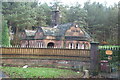
Photos of L28 4EX


Area Information
Living in L28 4EX means inhabiting a compact residential cluster in England, where 1422 people reside across 2.8 hectares. The area’s high population density—51,520 people per square kilometre—reflects its small footprint and focused development. This postcode is defined by its proximity to key amenities and transport links, making it a practical choice for those prioritising convenience. The community here is predominantly composed of adults aged 30–64, with a median age of 47, suggesting a mature demographic profile. While the area lacks natural landscapes or protected sites, its strategic location near rail and ferry services offers connectivity to broader regions. Daily life is shaped by its compact size, where residents can access shops, schools, and public transport within short distances. The area’s character is one of efficiency, with a focus on accessibility rather than sprawling development. For buyers, it’s a niche market where property choices are limited but concentrated, and where the emphasis is on proximity to essential services rather than expansive living spaces.
- Area Type
- Postcode
- Area Size
- 2.8 hectares
- Population
- 1422
- Population Density
- 3208 people/km²
The property market in L28 4EX is characterised by a low home ownership rate of 13%, suggesting it is primarily a rental area. The accommodation type is predominantly flats, which aligns with the compact nature of the postcode and its limited land area of 2.8 hectares. This suggests a lack of larger family homes or detached properties, making the area more suited to individuals or couples rather than growing families. Buyers considering this small area should note the limited housing stock and the potential for competition among renters. The proximity to transport hubs, such as Roby and Huyton railway stations, may enhance the area’s appeal for commuters, though the small size means development opportunities are constrained. For those seeking property, the focus would be on proximity to essential services rather than expansive living spaces, with the market likely dominated by landlords rather than private homeowners.
House Prices in L28 4EX
Showing 19 properties
| Address | Type | Beds | Baths | Last Sale Price | Last Sale Date | |
|---|---|---|---|---|---|---|
| 2 Haywood Road, Stockbridge Village, L28 4EX | Detached | 3 | 1 | £195,000 | Sep 2024 | |
| 21 Haywood Road, Stockbridge Village, L28 4EX | house | - | - | £100,000 | Feb 2023 | |
| 9 Haywood Road, Stockbridge Village, L28 4EX | Semi-detached | 3 | 1 | £150,000 | Feb 2023 | |
| 4 Haywood Road, Stockbridge Village, L28 4EX | house | - | - | £119,000 | Sep 2021 | |
| 3 Haywood Road, Stockbridge Village, L28 4EX | Semi-detached | 3 | 2 | £66,000 | Jul 2015 | |
| 16 Haywood Road, Stockbridge Village, L28 4EX | Semi-detached | 3 | 1 | £122,395 | Feb 2008 | |
| 18 Haywood Road, Stockbridge Village, L28 4EX | Semi-detached | 3 | 1 | £127,500 | Feb 2008 | |
| 12 Haywood Road, Stockbridge Village, L28 4EX | house | - | - | £127,000 | Feb 2008 | |
| 17 Haywood Road, Stockbridge Village, L28 4EX | Semi-detached | 3 | 2 | £132,995 | Feb 2008 | |
| 15 Haywood Road, Stockbridge Village, L28 4EX | Semi-detached | 3 | 2 | £132,995 | Feb 2008 |
Energy Efficiency in L28 4EX
Lifestyle in L28 4EX is shaped by its proximity to retail, transport, and ferry services. Nearby shops include Tesco Princess, Morrisons Daily, and Lidl Fincham, providing convenience for daily shopping. The area’s rail network, with stations such as Roby and Huyton, offers easy access to broader urban centres, while ferry terminals at Liverpool Belfast and Pier Head connect residents to maritime travel options. Though the area lacks detailed information on parks or leisure facilities, its compact design ensures that essential services are within practical reach. The mix of retail and transport infrastructure suggests a focus on efficiency, making it suitable for those who prioritise accessibility over expansive recreational spaces. For residents, the lifestyle is defined by practicality, with minimal need to travel far for basic needs. The presence of a ‘good’ primary school and nearby rail links further enhances its appeal for families and commuters.
Amenities
Schools
Residents of L28 4EX have access to two schools: Meadow Park School, which is categorised as ‘other’, and Stockbridge Village Primary School, rated ‘good’ by Ofsted. The presence of a primary school with a positive rating is a key consideration for families, though the absence of secondary schools in the immediate area may require commuting. The mix of school types suggests a focus on early education, but parents seeking comprehensive schooling may need to look beyond the postcode. The data does not indicate the number of pupils or student performance metrics, so further research would be needed to assess the full educational landscape. For now, the availability of a ‘good’ primary school is a practical advantage, though the lack of secondary options could be a limitation for some households.
| Rank | School | Type | Entry gender | Ages |
|---|
Explore more schools in this area
Go to Schools tabDemographics
The community in L28 4EX is predominantly composed of adults aged 30–64, with a median age of 47. Only 13% of residents own their homes, indicating a rental-heavy market. The area’s accommodation is primarily flats, reflecting a lack of larger residential properties. The predominant ethnic group is White, with no specific data on other demographics provided. The high population density—51,520 people per square kilometre—suggests a compact, possibly multi-generational living environment. With such a small area, social interactions may be more frequent, though the lack of detailed diversity statistics means the community’s full composition remains unclear. The age profile implies a population likely focused on established careers and family life, with fewer young children or retirees compared to other areas. This demographic structure could influence local services and amenities, though the data does not specify whether they meet current needs.
Household Size
Accommodation Type
Tenure
Ethnic Group
Religion
Household Composition
Age
Household Deprivation
NS-SEC
Explore more demographic insights in this area
Go to Demographics tabPlanning
Planning Constraints
- Flood RiskPremium
- Ramsar Wetland SitesPremium
- Area of Outstanding Natural BeautyPremium
- Protected Nature ReservePremium
- Protected WoodlandPremium