Area Overview for L28 4EP
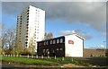
Photos of L28 4EP


Area Information
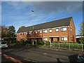
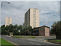
Living in L28 4EP means inhabiting a densely populated, compact residential cluster in England. With a population of 1,422 spread across just 1.0 hectare, this area is characterised by high density and a tightly knit community. The demographic profile suggests a mature population, with a median age of 47 and most residents aged between 30 and 64. This is a predominantly flat-based area, with 13% of homes owned outright and the majority rented. The proximity to amenities like Stockbridge Village Primary School, which holds a 'good' Ofsted rating, and nearby rail stations such as Roby and Huyton, highlights the practicality of daily life here. Residents benefit from excellent digital connectivity, with a broadband score of 99, though mobile coverage is slightly lower at 85. The area’s small size and high population density create a focused, perhaps insular environment, where proximity to services and transport is a key advantage. However, the high crime risk score of 32 underscores the need for caution. For those prioritising convenience and accessibility, L28 4EP offers a blend of urban living and practical infrastructure, though its challenges are as visible as its benefits.
- Area Type
- Postcode
- Area Size
- 1.0 hectares
- Population
- 1422
- Population Density
- 3208 people/km²
The property market in L28 4EP is dominated by flats, with 13% of homes owned by residents and the rest likely rented. This low home ownership rate indicates a rental market that may be competitive, given the area’s small size and high population density. The predominance of flats suggests a housing stock tailored to smaller households or individuals, possibly with limited scope for expansion or redevelopment. For buyers, this presents a challenge: the small area may not offer a wide range of properties, and the high demand for rental units could mean limited availability for purchase. The compact nature of the area means that any property here is likely to be in close proximity to amenities and transport links, which is a significant advantage. However, the high population density and limited home ownership also suggest that the market may be more responsive to rental demand than to long-term investment. Buyers should consider whether they are seeking a place to live or an asset to hold, given the area’s characteristics.
House Prices in L28 4EP
Showing 34 properties
| Address | Type | Beds | Baths | Last Sale Price | Last Sale Date | |
|---|---|---|---|---|---|---|
| 21 Pool Hey, Stockbridge Village, L28 4EP | house | - | - | £94,500 | Jan 2023 | |
| 15 Pool Hey, Stockbridge Village, L28 4EP | Terraced | 3 | 1 | £120,000 | Jan 2023 | |
| 16 Pool Hey, Stockbridge Village, L28 4EP | Terraced | 3 | 1 | £80,000 | Feb 2020 | |
| 11 Pool Hey, Stockbridge Village, L28 4EP | Semi-detached | 3 | 2 | £57,000 | May 2014 | |
| 14 Pool Hey, Stockbridge Village, L28 4EP | house | - | - | £29,500 | May 2003 | |
| 10 Pool Hey, Stockbridge Village, L28 4EP | house | - | - | £24,950 | Jul 1998 | |
| 25 Pool Hey, Stockbridge Village, L28 4EP | Terraced | - | - | £29,250 | May 1995 | |
| 9 Pool Hey, Stockbridge Village, L28 4EP | Terraced | 5 | - | - | - | |
| 2 Pool Hey, Stockbridge Village, L28 4EP | house | - | - | - | - | |
| 3 Pool Hey, Stockbridge Village, L28 4EP | Terraced | - | - | - | - |
Energy Efficiency in L28 4EP
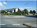
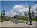
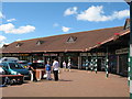
The lifestyle in L28 4EP is defined by proximity to practical amenities, including retail, transport, and water-based connectivity. Within reach are five notable retail outlets, such as Tesco Princess, Morrisons Daily, and Lidl Fincham, offering everyday shopping needs. The area’s rail stations—Roby, Huyton, and Broad Green—provide easy access to regional hubs, while nearby ferry terminals like Liverpool Belfast Ferry Terminal Bootle and Liverpool Pier Head Ferry Terminal connect residents to Belfast, the Isle of Man, and Dublin. These transport links are particularly useful for commuting or leisure travel. Though the data does not specify parks or leisure facilities, the presence of multiple retail and transport options suggests a functional, service-oriented lifestyle. The high population density and compact layout mean that residents can access essential services without long commutes, though the area may lack expansive green spaces or recreational facilities. For those prioritising convenience and connectivity, L28 4EP offers a practical, if limited, range of amenities that cater to daily living needs.
Amenities
Schools
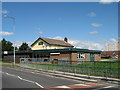
Residents of L28 4EP have access to two notable schools: Stockbridge Village Primary School, which holds a 'good' Ofsted rating, and Meadow Park School, though the latter’s specific type is listed as 'other'. The presence of a primary school with a positive rating is a strong draw for families, offering a reliable educational foundation for younger children. However, the absence of secondary school data means that families may need to look further afield for comprehensive schooling. The mix of school types suggests a focus on primary education within the area, which could be convenient for parents with young children. For those requiring secondary education, the nearby rail stations—such as Roby and Huyton—provide easy access to broader regional networks. The availability of a 'good' primary school is a key asset, but the lack of detailed information on secondary options may require additional research for families with older children.
| Rank | School | Type | Entry gender | Ages |
|---|
Explore more schools in this area
Go to Schools tabDemographics
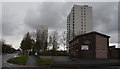
The community in L28 4EP is predominantly composed of adults aged 30 to 64, with a median age of 47. This suggests a mature, possibly working-age population with limited representation of younger or older demographics. Home ownership is low, at just 13%, indicating that the majority of residents are likely to be renters. The accommodation type is almost exclusively flats, reflecting a housing stock suited to smaller households or those seeking urban living. The predominant ethnic group is White, though no specific data on diversity or deprivation levels is provided. The population density of 137,688 people per square kilometre is exceptionally high, which may influence the character of the area, fostering a tightly packed, possibly communal atmosphere. This density, combined with the limited home ownership, suggests a transient or rental-driven community. The age profile implies a population focused on middle-aged or retired individuals, potentially with stable employment and established routines. However, the lack of data on income levels or deprivation means the full picture of quality of life remains partially obscured.
Household Size
Accommodation Type
Tenure
Ethnic Group
Religion
Household Composition
Age
Household Deprivation
NS-SEC
Explore more demographic insights in this area
Go to Demographics tabPlanning
Planning Constraints
- Flood RiskPremium
- Ramsar Wetland SitesPremium
- Area of Outstanding Natural BeautyPremium
- Protected Nature ReservePremium
- Protected WoodlandPremium