Area Overview for L27 8XS
Photos of L27 8XS
Area Information
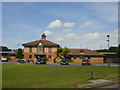
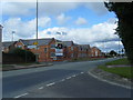
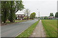
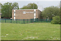
Living in L27 8XS means being part of a tightly knit residential cluster in England, where 1,312 people reside across 5,029 square metres. The area’s high population density of 260,882 people per square kilometre reflects its compact nature, typical of small postcode areas. This is a community where proximity to essential services and transport links is key. Residents benefit from nearby railway stations, including Huyton, Roby, and Halewood, offering connections to broader networks. The area’s proximity to Liverpool John Lennon Airport, just 2 kilometres away, makes it convenient for frequent flyers. Daily life here is shaped by the balance between residential tranquillity and accessible urban infrastructure. While the area lacks major green spaces or cultural landmarks, its practicality for commuters and those needing quick access to retail and transport is clear. For those prioritising convenience over sprawling landscapes, L27 8XS offers a straightforward, no-frills living experience.
- Area Type
- Postcode
- Area Size
- 5029 m²
- Population
- 1312
- Population Density
- 260882 people/km²
The property market in L27 8XS is characterised by a low home ownership rate of 34%, suggesting that rental properties dominate the housing stock. The area’s accommodation is primarily houses, which is unusual for a densely populated postcode area. This combination implies a market where owner-occupiers are a minority, and landlords may hold significant shares of the housing stock. For buyers, this presents a challenge: the limited number of owner-occupied homes may reduce the availability of properties for sale. The small area size and high density also mean that the immediate surroundings are likely to have similar housing profiles. Prospective buyers should consider the potential for long-term rental investment, though the lack of data on property prices or market trends means caution is advised. The focus on houses, rather than flats or apartments, may appeal to those seeking traditional family homes but could limit options in a competitive market.
House Prices in L27 8XS
Showing 17 properties
| Address | Type | Beds | Baths | Last Sale Price | Last Sale Date | |
|---|---|---|---|---|---|---|
| 7 Cloudberry Close, Liverpool, L27 8XS | Terraced | 3 | 1 | £88,000 | Nov 2019 | |
| 1 Cloudberry Close, Liverpool, L27 8XS | Terraced | - | - | £90,000 | Oct 2017 | |
| 12 Cloudberry Close, Liverpool, L27 8XS | Terraced | - | - | £32,000 | Feb 2013 | |
| 8 Cloudberry Close, Liverpool, L27 8XS | house | - | - | £96,500 | Nov 2007 | |
| 5 Cloudberry Close, Liverpool, L27 8XS | house | - | - | - | - | |
| 3 Cloudberry Close, Liverpool, L27 8XS | Terraced | - | - | - | - | |
| 4 Cloudberry Close, Liverpool, L27 8XS | Terraced | - | - | - | - | |
| 2 Cloudberry Close, Liverpool, L27 8XS | Terraced | - | - | - | - | |
| 10 Cloudberry Close, Liverpool, L27 8XS | house | - | - | - | - | |
| 18 Cloudberry Close, Liverpool, L27 8XS | house | - | - | - | - |
Energy Efficiency in L27 8XS
Residents of L27 8XS have access to a range of practical amenities within easy reach. The area’s retail options include Spar, Iceland Belle, and Morrisons Belle, providing everyday shopping convenience. Three railway stations—Huyton, Roby, and Halewood—offer frequent services to nearby towns and cities, while the nearby Liverpool John Lennon Airport is ideal for those requiring regular air travel. Though the area lacks major parks or leisure facilities, its proximity to rail networks and retail hubs makes it suitable for those prioritising connectivity over recreational spaces. The character of daily life here is defined by efficiency: shops, transport, and airports are all within a short journey. This makes L27 8XS appealing to commuters and professionals who value accessibility, though those seeking extensive green spaces or cultural amenities may find the area limited in that regard.
Amenities
Schools
| Rank | School | Type | Entry gender | Ages |
|---|
Explore more schools in this area
Go to Schools tabDemographics
The community in L27 8XS is predominantly composed of adults aged 30–64, with a median age of 47. This suggests a mature population, likely with established careers and families. Home ownership is relatively low at 34%, indicating that a significant portion of residents rent their homes. The area’s accommodation is primarily houses, reflecting a traditional housing stock. The predominant ethnic group is White, which aligns with broader demographic trends in the region. With a population density over 260,000 people per square kilometre, the area is densely populated, which may influence the availability of private outdoor space. The data does not indicate high deprivation levels, but the high density could impact local services and infrastructure pressure. This is a community defined by its age profile and housing type, with a focus on practical living over luxury.
Household Size
Accommodation Type
Tenure
Ethnic Group
Religion
Household Composition
Age
Household Deprivation
NS-SEC
Explore more demographic insights in this area
Go to Demographics tabPlanning
Planning Constraints
- Flood RiskPremium
- Ramsar Wetland SitesPremium
- Area of Outstanding Natural BeautyPremium
- Protected Nature ReservePremium
- Protected WoodlandPremium