Area Overview for L27 8YP
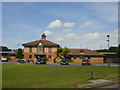
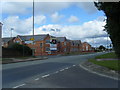
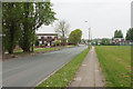
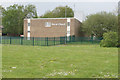
Photos of L27 8YP

Area Information
Living in L27 8YP means being part of a compact, densely populated residential cluster in England. The area covers 2,495 square metres and is home to 1,406 people, resulting in a population density of 563,469 people per square kilometre. This high density suggests a tightly knit community, though the area remains small enough to feel intimate. The postcode is primarily residential, with houses dominating the accommodation type. Daily life here is shaped by proximity to essential services, including multiple railway stations and retail outlets. The area’s broadband score of 99 indicates near-perfect digital connectivity, while mobile coverage of 85 is strong. For families, the presence of two primary schools—St Gregory’s Catholic Primary and St Gregory’s RC Infant—offers convenience for young children. While the area lacks expansive natural landscapes, its practical amenities and safety profile make it a viable option for those prioritising accessibility and security.
- Area Type
- Postcode
- Area Size
- 2495 m²
- Population
- 1406
- Population Density
- 2240 people/km²
The property market in L27 8YP is characterised by a 48% home ownership rate, meaning just under half of properties are owner-occupied. The remaining 52% are likely rented, suggesting a mix of private and rental housing. The accommodation type is predominantly houses, which is uncommon in densely populated areas and may indicate a focus on family-friendly, spacious homes. This configuration could appeal to buyers seeking larger properties, though the small area size and high density may limit availability. For those considering the market, the proximity to multiple railway stations and retail hubs adds practical value. However, the limited data on property prices or trends means buyers should explore nearby areas for broader options. The presence of houses rather than flats may also influence the types of buyers—those prioritising space over urban density.
House Prices in L27 8YP
Showing 9 properties
| Address | Type | Beds | Baths | Last Sale Price | Last Sale Date | |
|---|---|---|---|---|---|---|
| 19 Linden Road, Liverpool, L27 8YP | Terraced | 3 | 1 | £90,000 | Oct 2019 | |
| 29 Linden Road, Liverpool, L27 8YP | Terraced | 3 | 1 | £89,000 | Jul 2014 | |
| 23 Linden Road, Liverpool, L27 8YP | house | - | - | - | - | |
| 35 Linden Road, Liverpool, L27 8YP | house | - | - | - | - | |
| 21 Linden Road, Liverpool, L27 8YP | house | - | - | - | - | |
| 27 Linden Road, Liverpool, L27 8YP | Terraced | - | - | - | - | |
| 33 Linden Road, Liverpool, L27 8YP | house | - | - | - | - | |
| 25 Linden Road, Liverpool, L27 8YP | house | - | - | - | - | |
| 31 Linden Road, Liverpool, L27 8YP | Terraced | - | - | - | - |
Energy Efficiency in L27 8YP
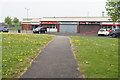
The lifestyle in L27 8YP is shaped by its proximity to retail, dining, and transport hubs. Nearby amenities include Spar, Morrisons Belle, and Iceland Belle, offering everyday shopping and grocery needs. The five railway stations provide easy access to regional services, while the two nearby airports cater to travel demands. Though the data does not list parks or leisure facilities, the area’s high population density suggests limited open spaces. However, the presence of multiple retail outlets and transport links implies a practical, convenience-driven lifestyle. For families, the schools and rail access make daily routines efficient, while the strong digital connectivity supports remote work. The area’s compact nature means residents can access essentials without long commutes, though those seeking expansive natural landscapes may need to venture further afield.
Amenities
Schools
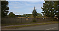
Residents of L27 8YP have access to two primary schools: St Gregory’s Catholic Primary School and St Gregory’s RC Infant School. Both institutions cater to younger children, with the former holding a ‘good’ Ofsted rating. The combination of infant and primary schooling provides a seamless educational pathway for families with children under 11. This concentration of primary-level education may reduce the need to travel for schooling, though no secondary schools are listed in the data. The presence of two schools in close proximity suggests a focus on early education, which could be a draw for families prioritising convenience. However, the absence of data on school capacity or catchment areas means prospective residents should verify admissions details independently.
| Rank | School | Type | Entry gender | Ages |
|---|
Explore more schools in this area
Go to Schools tabDemographics
The median age in L27 8YP is 47, with the most common age range being adults aged 30–64. This suggests a mature, stable population, likely with established careers and families. Home ownership rates stand at 48%, indicating that over half of residents rent their homes. The accommodation type is predominantly houses, which may reflect a preference for larger living spaces. The predominant ethnic group is White, though no data on diversity or deprivation levels is provided. The high population density—563,469 people per square kilometre—implies a compact, possibly urbanised environment. For quality of life, the low crime risk score of 70 (with lower scores indicating less risk) suggests a generally safe area. However, the lack of specific data on deprivation or income levels means the full picture of socioeconomic conditions remains unclear.
Household Size
Accommodation Type
Tenure
Ethnic Group
Religion
Household Composition
Age
Household Deprivation
NS-SEC
Explore more demographic insights in this area
Go to Demographics tabPlanning
Planning Constraints
- Flood RiskPremium
- Ramsar Wetland SitesPremium
- Area of Outstanding Natural BeautyPremium
- Protected Nature ReservePremium
- Protected WoodlandPremium