Area Overview for L27 8AB
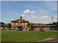
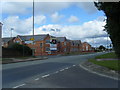
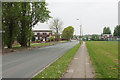
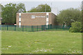
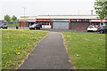
Photos of L27 8AB
Area Information
Living in L27 8AB means being part of a tightly knit residential cluster in England, where 1406 people reside across 1154 square metres. The area’s high population density reflects its compact nature, yet it offers a sense of community for those who value proximity to local amenities. With a median age of 47, the population skews towards adults aged 30–64, suggesting a stable, established demographic. The presence of two primary schools, St Gregory’s Catholic Primary and St Gregory’s RC Infant School, underscores the area’s appeal to families. Daily life here balances practicality with accessibility: residents benefit from excellent broadband connectivity (a score of 99) and reliable mobile coverage (85), supporting both work and leisure. While the area lacks natural conservation designations, its low crime risk—rated 70/100—adds to its appeal. For buyers, L27 8AB offers a snapshot of suburban living, where homes are predominantly owner-occupied and the rhythm of life is shaped by local shops, rail links, and family-focused amenities.
- Area Type
- Postcode
- Area Size
- 1154 m²
- Population
- 1406
- Population Density
- 1218641 people/km²
The property market in L27 8AB is characterised by a 48% home ownership rate, indicating that nearly half of the area’s properties are owner-occupied, while the remainder are likely rental units. The accommodation type is predominantly houses, which suggests a focus on family-friendly or semi-detached housing. This mix may appeal to buyers seeking spacious, traditional homes rather than flats or apartments. Given the area’s small size and high population density, property availability is limited, making it a niche market for those prioritising proximity to local amenities. The presence of two primary schools further strengthens the area’s appeal to families, potentially driving demand for homes with space for children. However, the compact nature of L27 8AB means buyers should consider the surrounding areas for broader options, though the immediate vicinity offers a cohesive, community-oriented environment.
House Prices in L27 8AB
Showing 6 properties
| Address | Type | Beds | Baths | Last Sale Price | Last Sale Date | |
|---|---|---|---|---|---|---|
| 4 Saffron Close, Liverpool, L27 8AB | house | - | - | - | - | |
| 2 Saffron Close, Liverpool, L27 8AB | house | - | - | - | - | |
| 1 Saffron Close, Liverpool, L27 8AB | house | - | - | - | - | |
| 5 Saffron Close, Liverpool, L27 8AB | house | - | - | - | - | |
| 6 Saffron Close, Liverpool, L27 8AB | house | - | - | - | - | |
| 3 Saffron Close, Liverpool, L27 8AB | house | - | - | - | - |
Energy Efficiency in L27 8AB
Daily life in L27 8AB is shaped by its proximity to essential amenities. Nearby retail options include Spar, Morrisons Belle, and Iceland Belle, offering a range of shopping and grocery needs within easy reach. These stores provide convenience for residents, reducing the need for long trips to larger centres. The area’s rail stations—Huyton, Roby, and Halewood—add to its practicality, enabling swift travel to nearby towns or cities. While the data does not mention parks or leisure facilities, the presence of schools and retail hubs suggests a community-oriented lifestyle focused on family and local engagement. The compact nature of L27 8AB means amenities are tightly clustered, fostering a sense of accessibility. For those who enjoy a mix of retail, transport links, and a quiet residential setting, this area offers a straightforward, functional lifestyle without the need for extensive travel.
Amenities
Schools
Residents of L27 8AB have access to two primary schools: St Gregory’s Catholic Primary School, which holds an Ofsted rating of ‘good’, and St Gregory’s RC Infant School. Both institutions cater to younger children, providing a seamless educational pathway for families. The presence of two primary schools within proximity reduces the need for long commutes, a significant advantage for parents balancing work and school runs. The ‘good’ rating at St Gregory’s Catholic Primary indicates a school meeting acceptable standards in teaching and outcomes, though no data is available on the infant school’s Ofsted status. For families, this cluster of schools suggests a focus on early education, potentially making L27 8AB an attractive option for those prioritising local schooling. The absence of secondary schools nearby, however, may require families to look further afield for comprehensive education.
| Rank | School | Type | Entry gender | Ages |
|---|
Explore more schools in this area
Go to Schools tabDemographics
The community in L27 8AB is predominantly composed of adults aged 30–64, with a median age of 47. This suggests a mature population, likely settled in long-term residences. Home ownership here stands at 48%, indicating a mix of owner-occupied properties and rental units. The accommodation type is primarily houses, reflecting a residential area suited to families or individuals preferring standalone homes. The predominant ethnic group is White, with no specific data on other demographics provided. The high population density—1218641 people per square kilometre—implies a compact, efficient use of space, though it may influence the availability of larger properties. For quality of life, the low crime risk (70/100) and absence of environmental constraints suggest a stable, low-stress environment. However, the lack of diversity data means the area’s cultural or social dynamics remain unexplored in this context.
Household Size
Accommodation Type
Tenure
Ethnic Group
Religion
Household Composition
Age
Household Deprivation
NS-SEC
Explore more demographic insights in this area
Go to Demographics tabPlanning
Planning Constraints
- Flood RiskPremium
- Ramsar Wetland SitesPremium
- Area of Outstanding Natural BeautyPremium
- Protected Nature ReservePremium
- Protected WoodlandPremium