Area Overview for L27 8AD
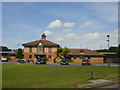
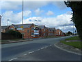
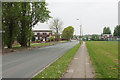
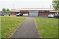
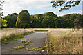
Photos of L27 8AD

Area Information
Living in L27 8AD means being part of a compact, densely populated residential cluster in England. The area covers just 2,694 square metres, yet it is home to 1,312 residents, resulting in a population density of 487,076 people per square kilometre. This high density suggests a tightly knit community, where proximity to neighbours is inevitable. The area’s small size means amenities and services are likely within walking distance, though the exact nature of daily life here depends on the mix of local businesses and public transport. With a median age of 47, the population skews towards adults in their 30s to 60s, indicating a stable, mature demographic. While the area lacks natural or protected landscapes, its proximity to rail stations and airports offers connectivity to larger urban centres. For those seeking a quiet, residential environment with practical access to transport, L27 8AD may appeal, though its limited size means the community is both intimate and highly concentrated.
- Area Type
- Postcode
- Area Size
- 2694 m²
- Population
- 1312
- Population Density
- 2224 people/km²
The property market in L27 8AD is characterised by a low home ownership rate of 34%, suggesting that the majority of housing is rented rather than owned. This could indicate a rental market dominated by private landlords or housing associations, with limited opportunities for long-term equity building. The accommodation type is primarily houses, which is atypical for an area of this small size, potentially pointing to a mix of older, larger properties or a focus on family homes. Given the high population density, the housing stock may be tightly packed, with limited scope for expansion. Buyers considering this area should note the small footprint of the postcode, which may restrict property options. The low home ownership rate also implies that the local market may be less driven by investment or speculative buying, instead serving a population with more transient or rental-focused needs.
House Prices in L27 8AD
Showing 5 properties
| Address | Type | Beds | Baths | Last Sale Price | Last Sale Date | |
|---|---|---|---|---|---|---|
| 4 Hibiscus Close, Liverpool, L27 8AD | Bungalow | - | - | - | - | |
| 3 Hibiscus Close, Liverpool, L27 8AD | Bungalow | - | - | - | - | |
| 1 Hibiscus Close, Liverpool, L27 8AD | house | - | - | - | - | |
| 5 Hibiscus Close, Liverpool, L27 8AD | Detached | - | - | - | - | |
| 2 Hibiscus Close, Liverpool, L27 8AD | house | - | - | - | - |
Energy Efficiency in L27 8AD
The lifestyle in L27 8AD is shaped by its proximity to essential amenities. Within practical reach are five retail outlets, including Spar, Iceland Belle, and Morrisons Belle, providing everyday shopping and grocery needs. The area’s rail stations—Huyton, Roby, and Halewood—offer frequent services to surrounding regions, while Liverpool John Lennon Airport is within easy reach for travel. Though the data does not mention parks or leisure facilities, the high population density suggests that local community spaces may be shared or limited. The presence of multiple supermarkets and rail links indicates a focus on convenience, with residents able to access both daily essentials and broader regional connections. The compact nature of the area means that amenities are likely within walking or short driving distance, though the lack of detailed information on leisure options means the full character of the community’s lifestyle remains partially undefined.
Amenities
Schools
| Rank | School | Type | Entry gender | Ages |
|---|
Explore more schools in this area
Go to Schools tabDemographics
The community in L27 8AD is predominantly composed of adults aged 30 to 64, with a median age of 47. This suggests a population that is largely in their prime working years, though the absence of younger families or retirees is notable. Home ownership rates are relatively low at 34%, indicating that a majority of residents rent their homes. The accommodation type is primarily houses, which is unusual for an area of this size, implying a mix of single-family homes and possibly larger properties. The predominant ethnic group is White, though the data does not specify further diversity metrics. With a population density over 480,000 people per square kilometre, the area is intensely populated, which may influence local dynamics such as shared community spaces and resource availability. The high density, combined with the age profile, suggests a community focused on stability and routine, with limited evidence of recent demographic shifts.
Household Size
Accommodation Type
Tenure
Ethnic Group
Religion
Household Composition
Age
Household Deprivation
NS-SEC
Explore more demographic insights in this area
Go to Demographics tabPlanning
Planning Constraints
- Flood RiskPremium
- Ramsar Wetland SitesPremium
- Area of Outstanding Natural BeautyPremium
- Protected Nature ReservePremium
- Protected WoodlandPremium