Area Overview for L25 0PZ
Photos of L25 0PZ
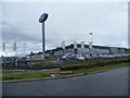
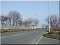
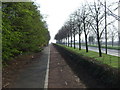
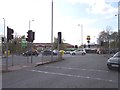
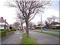
11 photos from this area
Area Information
Key information about the L25 0PZ including its size, population, and administrative classification.
- Area Type
- Postcode
- Area Size
- 1.8 hectares
- Population
- 2521
- Population Density
- 2344 people/km²
House Prices in L25 0PZ
52
Properties
£122,059
Average Sold Price
£38,000
Lowest Price
£287,500
Highest Price
Showing 52 properties
| Address | Type | Beds | Baths | Last Sale Price | Last Sale Date | |
|---|---|---|---|---|---|---|
| 36 Leafield Road, Liverpool, L25 0PZ | Semi-detached | 3 | 2 | £287,500 | Jun 2025 | |
| 24 Leafield Road, Liverpool, L25 0PZ | house | - | - | £181,500 | Oct 2021 | |
| 50 Leafield Road, Liverpool, L25 0PZ | Semi-detached | 3 | 2 | £174,000 | Oct 2020 | |
| 54 Leafield Road, Liverpool, L25 0PZ | Semi-detached | 3 | 1 | £165,000 | Aug 2019 | |
| 42 Leafield Road, Liverpool, L25 0PZ | house | - | - | £150,300 | Oct 2018 | |
| 60 Leafield Road, Liverpool, L25 0PZ | Semi-detached | 3 | 1 | £175,000 | Feb 2018 | |
| 2 Leafield Road, Liverpool, L25 0PZ | Semi-detached | 5 | 2 | £196,500 | Aug 2017 | |
| 96 Leafield Road, Liverpool, L25 0PZ | Terraced | 3 | 1 | £129,950 | Jun 2017 | |
| 68 Leafield Road, Liverpool, L25 0PZ | Semi-detached | 3 | - | £115,000 | Jul 2014 | |
| 38 Leafield Road, Liverpool, L25 0PZ | Semi-detached | 3 | - | £110,000 | Oct 2012 |
Page 1 of 6
Energy Efficiency in L25 0PZ
Amenities
Schools
| Rank | School | Type | Entry gender | Ages |
|---|
Explore more schools in this area
Go to Schools tabDemographics
Household Size
Family (3-5 people)
most common
Accommodation Type
Houses
most common
Tenure
66
majority
Ethnic Group
White
most common
Religion
N/A
most common
Household Composition
N/A
most common
Age
47
median
Adults (30-64 years)
most common
Household Deprivation
N/A
with no deprivation
NS-SEC
32
in Lower managerial occupations
Explore more demographic insights in this area
Go to Demographics tabPlanning
Planning Constraints
- Flood RiskPremium
- Ramsar Wetland SitesPremium
- Area of Outstanding Natural BeautyPremium
- Protected Nature ReservePremium
- Protected WoodlandPremium