Area Overview for L25 0PY
Photos of L25 0PY
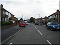
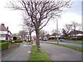
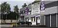
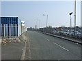
11 photos from this area
Area Information
Key information about the L25 0PY including its size, population, and administrative classification.
- Area Type
- Postcode
- Area Size
- 1.7 hectares
- Population
- 2521
- Population Density
- 2344 people/km²
House Prices in L25 0PY
49
Properties
£123,235
Average Sold Price
£700
Lowest Price
£285,000
Highest Price
Showing 49 properties
| Address | Type | Beds | Baths | Last Sale Price | Last Sale Date | |
|---|---|---|---|---|---|---|
| 83 Leafield Road, Liverpool, L25 0PY | Semi-detached | 3 | 1 | £285,000 | Mar 2025 | |
| 3 Leafield Road, Liverpool, L25 0PY | Semi-detached | 3 | 1 | £185,000 | Mar 2025 | |
| 59 Leafield Road, Liverpool, L25 0PY | Semi-detached | 3 | 1 | £195,000 | Nov 2024 | |
| 23 Leafield Road, Liverpool, L25 0PY | Terraced | - | - | £700 | Aug 2023 | |
| 63 Leafield Road, Liverpool, L25 0PY | house | - | - | £235,000 | Aug 2021 | |
| 33 Leafield Road, Liverpool, L25 0PY | Semi-detached | 3 | - | £153,000 | Jun 2018 | |
| 45 Leafield Road, Liverpool, L25 0PY | house | - | - | £140,000 | Mar 2016 | |
| 71 Leafield Road, Liverpool, L25 0PY | Semi-detached | 3 | 1 | £148,000 | Jul 2015 | |
| 17 Leafield Road, Liverpool, L25 0PY | Semi-detached | 3 | - | £105,000 | Jun 2014 | |
| 73 Leafield Road, Liverpool, L25 0PY | house | - | - | £147,500 | Dec 2009 |
Page 1 of 5
Energy Efficiency in L25 0PY
Amenities
Schools
| Rank | School | Type | Entry gender | Ages |
|---|
Explore more schools in this area
Go to Schools tabDemographics
Household Size
Family (3-5 people)
most common
Accommodation Type
Houses
most common
Tenure
66
majority
Ethnic Group
White
most common
Religion
N/A
most common
Household Composition
N/A
most common
Age
47
median
Adults (30-64 years)
most common
Household Deprivation
N/A
with no deprivation
NS-SEC
32
in Lower managerial occupations
Explore more demographic insights in this area
Go to Demographics tabPlanning
Planning Constraints
- Flood RiskPremium
- Ramsar Wetland SitesPremium
- Area of Outstanding Natural BeautyPremium
- Protected Nature ReservePremium
- Protected WoodlandPremium