Area Overview for L22 2AA
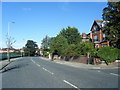
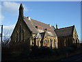
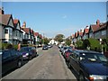
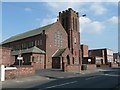
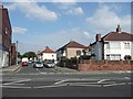
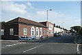
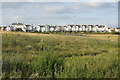
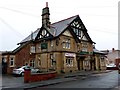
Photos of L22 2AA


Area Information
Living in L22 2AA means being part of a tightly knit residential cluster in England, where 1,581 people reside across 3,008 square metres. The area’s density is striking — over 525,000 people per square kilometre — suggesting a compact, possibly urbanised layout. This postcode is defined by its small size and proximity to key infrastructure. Daily life here is shaped by its limited space and the presence of nearby amenities, from retail hubs to transport links. The median age of 47 indicates a mature population, with most residents falling into the 30–64 age bracket. This suggests a community of established professionals and families, with a strong emphasis on home ownership, where 51% of properties are owner-occupied. While the area lacks natural landscapes or protected sites, its strategic location near rail, ferry, and retail networks makes it a practical choice for those prioritising connectivity over open space. For buyers, L22 2AA offers a snapshot of a densely populated, functional living environment, ideal for those seeking proximity to services but with limited room for expansion.
- Area Type
- Postcode
- Area Size
- 3008 m²
- Population
- 1581
- Population Density
- 6362 people/km²
The property market in L22 2AA is characterised by a 51% home ownership rate, with houses making up the majority of accommodation types. This suggests a market where owner-occupation is common, though not dominant. Given the area’s small size and high population density, the housing stock is likely limited to existing properties, with little scope for new developments. The presence of houses rather than flats or apartments may appeal to buyers seeking more space, though the compact nature of the postcode means properties are unlikely to be large. For those considering the area, the market is likely to be competitive, with limited options for first-time buyers or those seeking to expand their property portfolio. The high density also means proximity to amenities is a key selling point, though buyers should factor in the area’s constraints when assessing long-term value.
House Prices in L22 2AA
No properties found in this postcode.
Energy Efficiency in L22 2AA
The lifestyle in L22 2AA is shaped by its proximity to retail, transport, and ferry hubs. Residents have access to major supermarkets like Iceland Waterloo and Tesco Liverpool, alongside local Co-ops, making daily shopping straightforward. Rail stations such as Waterloo Railway Station and Seaforth & Litherland Railway Station provide easy access to regional networks, while ferry terminals like Seacombe Ferry Terminal connect to Belfast and the Isle of Man. Although the data does not mention parks or leisure facilities, the area’s density suggests a focus on practicality over expansive green spaces. The presence of multiple retail and transport points indicates a community designed for convenience, with amenities clustered to serve daily needs. For those valuing accessibility and proximity to services, L22 2AA offers a compact, functional lifestyle.
Amenities
Schools
The nearest schools to L22 2AA include Waterloo Primary School, which is listed twice in the data. Both entries confirm it is a primary school, though no Ofsted ratings or additional details are provided. The absence of secondary schools in the data means families with older children may need to look beyond the immediate area for secondary education. The presence of a primary school suggests the area is suitable for young families, though the lack of diversity in school types — only primary options — may limit choices for those requiring a broader range of educational facilities. For buyers prioritising schools, Waterloo Primary School is a notable feature, but further research would be needed to assess its quality and proximity to other educational institutions.
| Rank | School | Type | Entry gender | Ages |
|---|
Explore more schools in this area
Go to Schools tabDemographics
The population of L22 2AA skews towards adults aged 30–64, with a median age of 47. This suggests a community of middle-aged individuals, likely with established careers and families. Home ownership sits at 51%, meaning nearly half of residents live in properties they own, while the remaining 49% are likely renters. The accommodation type is predominantly houses, which is unusual for a small, high-density area. This mix may indicate a blend of semi-detached or terraced homes. The predominant ethnic group is White, with no specific data on other demographics. The high population density — over 525,000 people per square kilometre — implies limited space for new development, which could impact housing availability. For buyers, this means a market focused on existing properties, with little room for new builds. The age profile also suggests a stable, low-turnover community, which may appeal to those seeking a settled environment.
Household Size
Accommodation Type
Tenure
Ethnic Group
Religion
Household Composition
Age
Household Deprivation
NS-SEC
Explore more demographic insights in this area
Go to Demographics tabPlanning
Planning Constraints
- Flood RiskPremium
- Ramsar Wetland SitesPremium
- Area of Outstanding Natural BeautyPremium
- Protected Nature ReservePremium
- Protected WoodlandPremium