Area Overview for L22 1RX
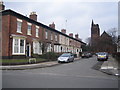
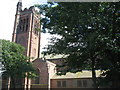
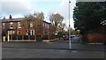
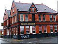
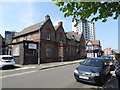
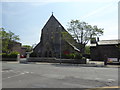
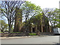
Photos of L22 1RX
Area Information
Living in L22 1RX means inhabiting a compact, densely populated residential cluster in England. The area covers 3,031 square metres and is home to 1,572 residents, resulting in a population density of 1,326 people per square kilometre. This small postcode area is characterised by its proximity to key transport hubs and retail amenities, making it a practical choice for those prioritising connectivity. The community is predominantly composed of adults aged 30–64, with a median age of 47, suggesting a mature, stable population. While the area lacks natural or protected landscapes, its low flood risk and absence of environmental constraints make it a safe base for daily life. However, residents should be mindful of the high crime risk, which is above average. The mix of retail, rail, and ferry access ensures that essentials are within reach, though the compact size means the area is best suited for those seeking convenience over expansive living spaces.
- Area Type
- Postcode
- Area Size
- 3031 m²
- Population
- 1572
- Population Density
- 1326 people/km²
The property market in L22 1RX is shaped by its small size and high population density. With only 35% of residents owning their homes, the area is primarily a rental market, reflecting limited opportunities for home ownership. The accommodation type is predominantly flats, which aligns with the compact nature of the postcode and the need for efficient land use. This suggests that the housing stock is suited to individuals or families seeking smaller, manageable living spaces rather than larger properties. For buyers, the area’s limited size and high density mean that options are constrained, and competition for available properties may be fierce. Prospective buyers should consider whether the flat-based market and rental focus align with their long-term goals, as the area is unlikely to offer the same investment potential as more expansive or mixed-use neighbourhoods.
House Prices in L22 1RX
Showing 1 properties
| Address | Type | Beds | Baths | Last Sale Price | Last Sale Date | |
|---|---|---|---|---|---|---|
| Merseyside Police, Crosby Police Station, Alexandra Road, Waterloo, L22 1RX | commercial | - | - | - | - |
Energy Efficiency in L22 1RX
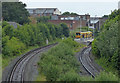
The lifestyle in L22 1RX is defined by its proximity to essential amenities and transport links. Within practical reach are retail options such as Iceland Waterloo, Co-op Waterloo, and Tesco Liverpool, providing access to groceries and daily necessities. The area’s rail network includes Waterloo Railway Station, Seaforth & Litherland Railway Station, and Blundellsands & Crosby Railway Station, offering direct routes to nearby towns and cities. Ferry services from terminals like Liverpool Belfast and Seacombe connect residents to regional destinations, including the Isle of Man and Dublin. While the area lacks expansive parks or leisure facilities, its compact design ensures that shops, transport, and services are within walking or short transit distance. This convenience is ideal for those prioritising accessibility over large-scale recreational spaces, though the high density may limit opportunities for open, green environments.
Amenities
Schools
| Rank | School | Type | Entry gender | Ages |
|---|
Explore more schools in this area
Go to Schools tabDemographics
The community in L22 1RX is defined by its age profile and housing patterns. With a median age of 47 and the majority of residents falling within the 30–64 age range, the area is dominated by working-age adults. Home ownership is relatively low at 35%, indicating that a significant portion of the population rents their homes. The predominant accommodation type is flats, reflecting the area’s compact layout and high population density. The predominant ethnic group is White, though the data does not specify further diversity metrics. At 1,326 people per square kilometre, the population density is exceptionally high, which may influence the character of the community, fostering a close-knit but potentially crowded environment. This density, combined with the age profile, suggests a mix of long-term residents and those in transitional life stages, such as middle-aged professionals or retirees.
Household Size
Accommodation Type
Tenure
Ethnic Group
Religion
Household Composition
Age
Household Deprivation
NS-SEC
Explore more demographic insights in this area
Go to Demographics tabPlanning
Planning Constraints
- Flood RiskPremium
- Ramsar Wetland SitesPremium
- Area of Outstanding Natural BeautyPremium
- Protected Nature ReservePremium
- Protected WoodlandPremium