Area Overview for L19 4UZ
Photos of L19 4UZ
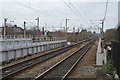
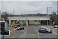
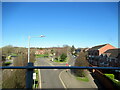
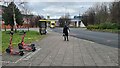
25 photos from this area
Area Information
Key information about the L19 4UZ including its size, population, and administrative classification.
- Area Type
- Postcode
- Area Size
- 1.0 hectares
- Population
- 1816
- Population Density
- 2731 people/km²
House Prices in L19 4UZ
28
Properties
£143,800
Average Sold Price
£40,050
Lowest Price
£256,155
Highest Price
Showing 28 properties
| Address | Type | Beds | Baths | Last Sale Price | Last Sale Date | |
|---|---|---|---|---|---|---|
| 1 Ramsey Road, Liverpool, L19 4UZ | Semi-detached | 3 | 1 | £246,000 | Aug 2025 | |
| 3 Ramsey Road, Liverpool, L19 4UZ | Semi-detached | 3 | 1 | £256,155 | Feb 2025 | |
| 18 Ramsey Road, Liverpool, L19 4UZ | Semi-detached | 3 | 1 | £220,000 | Sep 2024 | |
| 6 Ramsey Road, Liverpool, L19 4UZ | Semi-detached | 3 | 2 | £190,000 | Aug 2018 | |
| 27 Ramsey Road, Liverpool, L19 4UZ | Semi-detached | 3 | 2 | £157,500 | Dec 2017 | |
| 33 Ramsey Road, Liverpool, L19 4UZ | house | - | - | £90,000 | Dec 2011 | |
| 2 Ramsey Road, Liverpool, L19 4UZ | Semi-detached | 3 | 1 | £120,000 | Sep 2011 | |
| 14 Ramsey Road, Liverpool, L19 4UZ | house | - | - | £130,000 | Feb 2010 | |
| 9 Ramsey Road, Liverpool, L19 4UZ | house | - | - | £128,500 | Oct 2009 | |
| 5 Ramsey Road, Liverpool, L19 4UZ | house | - | - | £160,000 | Jul 2008 |
Page 1 of 3
Energy Efficiency in L19 4UZ
Amenities
Schools
| Rank | School | Type | Entry gender | Ages |
|---|
Explore more schools in this area
Go to Schools tabDemographics
Household Size
Family (3-5 people)
most common
Accommodation Type
Houses
most common
Tenure
62
majority
Ethnic Group
White
most common
Religion
N/A
most common
Household Composition
N/A
most common
Age
47
median
Adults (30-64 years)
most common
Household Deprivation
N/A
with no deprivation
NS-SEC
23
in Lower managerial occupations
Explore more demographic insights in this area
Go to Demographics tabPlanning
Planning Constraints
- Flood RiskPremium
- Ramsar Wetland SitesPremium
- Area of Outstanding Natural BeautyPremium
- Protected Nature ReservePremium
- Protected WoodlandPremium