Area Overview for L19 4UL
Photos of L19 4UL

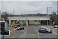
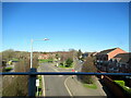
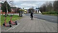
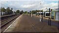
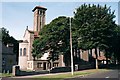
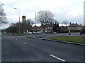
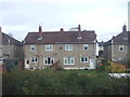
25 photos from this area
Area Information
Key information about the L19 4UL including its size, population, and administrative classification.
- Area Type
- Postcode
- Area Size
- 1.5 hectares
- Population
- 1890
- Population Density
- 5881 people/km²
House Prices in L19 4UL
37
Properties
£155,966
Average Sold Price
£40,000
Lowest Price
£265,000
Highest Price
Showing 37 properties
| Address | Type | Beds | Baths | Last Sale Price | Last Sale Date | |
|---|---|---|---|---|---|---|
| 26 Mostyn Avenue, Liverpool, L19 4UL | house | 3 | 1 | £265,000 | Sep 2025 | |
| 36 Mostyn Avenue, Liverpool, L19 4UL | Semi-detached | 3 | 2 | £262,000 | Mar 2025 | |
| 6 Mostyn Avenue, Liverpool, L19 4UL | house | 3 | 1 | £235,000 | Oct 2022 | |
| 8 Mostyn Avenue, Liverpool, L19 4UL | house | 3 | 1 | £225,000 | Sep 2022 | |
| 24 Mostyn Avenue, Liverpool, L19 4UL | house | - | - | £235,000 | Aug 2022 | |
| 17 Mostyn Avenue, Liverpool, L19 4UL | Semi-detached | 3 | 1 | £228,500 | May 2022 | |
| 14 Mostyn Avenue, Liverpool, L19 4UL | house | - | - | £200,000 | Feb 2022 | |
| 5 Mostyn Avenue, Liverpool, L19 4UL | Semi-detached | 3 | 1 | £163,000 | Jan 2020 | |
| 31 Mostyn Avenue, Liverpool, L19 4UL | Semi-detached | 3 | - | £160,000 | Feb 2018 | |
| 11 Mostyn Avenue, Liverpool, L19 4UL | house | 3 | - | £145,000 | May 2012 |
Page 1 of 4
Energy Efficiency in L19 4UL
Amenities
Schools
| Rank | School | Type | Entry gender | Ages |
|---|
Explore more schools in this area
Go to Schools tabDemographics
Household Size
Family (3-5 people)
most common
Accommodation Type
Houses
most common
Tenure
72
majority
Ethnic Group
White
most common
Religion
N/A
most common
Household Composition
N/A
most common
Age
47
median
Adults (30-64 years)
most common
Household Deprivation
N/A
with no deprivation
NS-SEC
39
in Lower managerial occupations
Explore more demographic insights in this area
Go to Demographics tabPlanning
Planning Constraints
- Flood RiskPremium
- Ramsar Wetland SitesPremium
- Area of Outstanding Natural BeautyPremium
- Protected Nature ReservePremium
- Protected WoodlandPremium