Area Overview for L19 4AB
Photos of L19 4AB


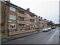
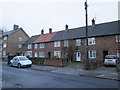
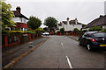
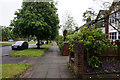

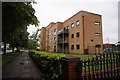
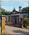
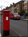


26 photos from this area
Area Information
Key information about the L19 4AB including its size, population, and administrative classification.
- Area Type
- Postcode
- Area Size
- 1.6 hectares
- Population
- 1890
- Population Density
- 5881 people/km²
House Prices in L19 4AB
21
Properties
£504,364
Average Sold Price
£5,200
Lowest Price
£715,000
Highest Price
Showing 21 properties
| Address | Type | Beds | Baths | Last Sale Price | Last Sale Date | |
|---|---|---|---|---|---|---|
| 91 Heath Road, Liverpool, L19 4AB | Detached | 4 | 3 | £680,000 | Mar 2025 | |
| 103 Heath Road, Liverpool, L19 4AB | Detached | 4 | 1 | £712,500 | Oct 2023 | |
| 105 Heath Road, Liverpool, L19 4AB | Detached | 5 | 3 | £715,000 | Feb 2023 | |
| 67 Heath Road, Liverpool, L19 4AB | Detached | 4 | 1 | £525,000 | Aug 2022 | |
| 71 Heath Road, Liverpool, L19 4AB | house | - | - | £430,000 | Sep 2021 | |
| 73 Heath Road, Liverpool, L19 4AB | Detached | 4 | 1 | £400,000 | Jul 2020 | |
| 95 Heath Road, Liverpool, L19 4AB | Detached | 4 | 3 | £630,000 | Jun 2020 | |
| 87 Heath Road, Liverpool, L19 4AB | Detached | 4 | 1 | £5,200 | Mar 2019 | |
| 93 Heath Road, Liverpool, L19 4AB | Detached | 5 | 4 | £699,995 | Nov 2016 | |
| 65 Heath Road, Liverpool, L19 4AB | house | - | - | £374,995 | May 2016 |
Page 1 of 3
Energy Efficiency in L19 4AB
Amenities
Schools
| Rank | School | Type | Entry gender | Ages |
|---|
Explore more schools in this area
Go to Schools tabDemographics
Household Size
Family (3-5 people)
most common
Accommodation Type
Houses
most common
Tenure
72
majority
Ethnic Group
White
most common
Religion
N/A
most common
Household Composition
N/A
most common
Age
47
median
Adults (30-64 years)
most common
Household Deprivation
N/A
with no deprivation
NS-SEC
39
in Lower managerial occupations
Explore more demographic insights in this area
Go to Demographics tabPlanning
Planning Constraints
- Flood RiskPremium
- Ramsar Wetland SitesPremium
- Area of Outstanding Natural BeautyPremium
- Protected Nature ReservePremium
- Protected WoodlandPremium