Area Overview for L18 9AD
Photos of L18 9AD


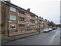
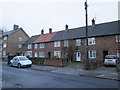
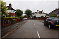
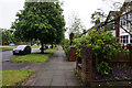
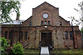
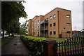
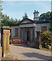
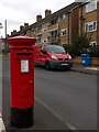


26 photos from this area
Area Information
Key information about the L18 9AD including its size, population, and administrative classification.
- Area Type
- Postcode
- Area Size
- 2.1 hectares
- Population
- 1890
- Population Density
- 5881 people/km²
House Prices in L18 9AD
25
Properties
£758,969
Average Sold Price
£6,500
Lowest Price
£1,312,500
Highest Price
Showing 25 properties
| Address | Type | Beds | Baths | Last Sale Price | Last Sale Date | |
|---|---|---|---|---|---|---|
| 10 Winterhill Close, Liverpool, L18 9AD | Detached | 5 | 4 | £1,312,500 | Oct 2023 | |
| 9 Winterhill Close, Liverpool, L18 9AD | house | - | - | £1,000,000 | May 2022 | |
| 5 Winterhill Close, Liverpool, L18 9AD | house | - | - | £887,500 | Sep 2021 | |
| 23 Winterhill Close, Liverpool, L18 9AD | house | - | - | £6,500 | Jun 2019 | |
| 4 Winterhill Close, Liverpool, L18 9AD | house | - | - | £704,995 | Jan 2017 | |
| 2 Winterhill Close, Liverpool, L18 9AD | house | - | - | £899,995 | Nov 2016 | |
| 19 Winterhill Close, Liverpool, L18 9AD | house | - | - | £699,995 | Oct 2016 | |
| 7 Winterhill Close, Liverpool, L18 9AD | house | - | - | £724,995 | Aug 2016 | |
| 17 Winterhill Close, Liverpool, L18 9AD | house | - | - | £599,995 | Aug 2016 | |
| 39 Winterhill Close, Liverpool, L18 9AD | house | - | - | £774,995 | May 2016 |
Page 1 of 3
Energy Efficiency in L18 9AD
Amenities
Schools
| Rank | School | Type | Entry gender | Ages |
|---|
Explore more schools in this area
Go to Schools tabDemographics
Household Size
Family (3-5 people)
most common
Accommodation Type
Houses
most common
Tenure
72
majority
Ethnic Group
White
most common
Religion
N/A
most common
Household Composition
N/A
most common
Age
47
median
Adults (30-64 years)
most common
Household Deprivation
N/A
with no deprivation
NS-SEC
39
in Lower managerial occupations
Explore more demographic insights in this area
Go to Demographics tabPlanning
Planning Constraints
- Flood RiskPremium
- Ramsar Wetland SitesPremium
- Area of Outstanding Natural BeautyPremium
- Protected Nature ReservePremium
- Protected WoodlandPremium