Area Overview for L18 1LU
Photos of L18 1LU
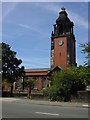
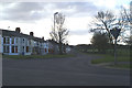
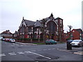
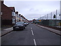
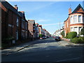

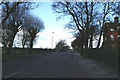
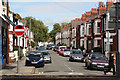
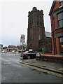
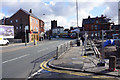
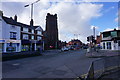
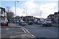
68 photos from this area
Area Information
Key information about the L18 1LU including its size, population, and administrative classification.
- Area Type
- Postcode
- Area Size
- 6770 m²
- Population
- 1449
- Population Density
- 7975 people/km²
House Prices in L18 1LU
42
Properties
£201,964
Average Sold Price
£34,500
Lowest Price
£402,000
Highest Price
Showing 42 properties
| Address | Type | Beds | Baths | Last Sale Price | Last Sale Date | |
|---|---|---|---|---|---|---|
| 41 Ashdale Road, Mossley Hill, Liverpool, L18 1LU | Terraced | 5 | 2 | £402,000 | May 2025 | |
| 32 Ashdale Road, Mossley Hill, Liverpool, L18 1LU | Terraced | 3 | - | £286,000 | Feb 2024 | |
| 43 Ashdale Road, Mossley Hill, Liverpool, L18 1LU | Terraced | 4 | 1 | £295,000 | Jan 2024 | |
| 45 Ashdale Road, Mossley Hill, Liverpool, L18 1LU | Terraced | 4 | 2 | £331,000 | Apr 2023 | |
| 2 Ashdale Road, Mossley Hill, Liverpool, L18 1LU | Terraced | 3 | 1 | £240,000 | Nov 2022 | |
| 9 Ashdale Road, Mossley Hill, Liverpool, L18 1LU | Terraced | 4 | 1 | £340,000 | Jul 2022 | |
| 18 Ashdale Road, Mossley Hill, Liverpool, L18 1LU | Terraced | 4 | 1 | £275,000 | Apr 2022 | |
| 6 Ashdale Road, Mossley Hill, Liverpool, L18 1LU | house | - | - | £266,000 | Sep 2021 | |
| 24 Ashdale Road, Mossley Hill, Liverpool, L18 1LU | Terraced | 4 | 2 | £238,000 | Sep 2021 | |
| 25 Ashdale Road, Mossley Hill, Liverpool, L18 1LU | Terraced | 4 | 1 | £295,500 | Aug 2021 |
Page 1 of 5
Energy Efficiency in L18 1LU
Amenities
Schools
| Rank | School | Type | Entry gender | Ages |
|---|
Explore more schools in this area
Go to Schools tabDemographics
Household Size
Family (3-5 people)
most common
Accommodation Type
Houses
most common
Tenure
64
majority
Ethnic Group
White
most common
Religion
N/A
most common
Household Composition
N/A
most common
Age
47
median
Adults (30-64 years)
most common
Household Deprivation
N/A
with no deprivation
NS-SEC
48
in Lower managerial occupations
Explore more demographic insights in this area
Go to Demographics tabPlanning
Planning Constraints
- Flood RiskPremium
- Ramsar Wetland SitesPremium
- Area of Outstanding Natural BeautyPremium
- Protected Nature ReservePremium
- Protected WoodlandPremium