Area Overview for L15 5BS
Photos of L15 5BS
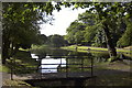
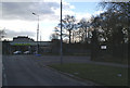
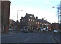
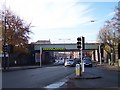
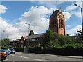
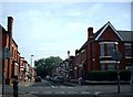
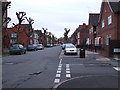
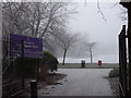
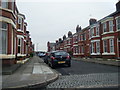
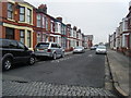
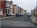
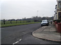
50 photos from this area
Area Information
Key information about the L15 5BS including its size, population, and administrative classification.
- Area Type
- Postcode
- Area Size
- 3484 m²
- Population
- 1577
- Population Density
- 5909 people/km²
House Prices in L15 5BS
28
Properties
£138,092
Average Sold Price
£40,000
Lowest Price
£270,000
Highest Price
Showing 28 properties
| Address | Type | Beds | Baths | Last Sale Price | Last Sale Date | |
|---|---|---|---|---|---|---|
| 28 Brierfield Road, Liverpool, L15 5BS | Terraced | 3 | 2 | £270,000 | Apr 2025 | |
| 27 Brierfield Road, Liverpool, L15 5BS | Terraced | 3 | 1 | £250,000 | Nov 2024 | |
| 13 Brierfield Road, Liverpool, L15 5BS | Terraced | 3 | 1 | £228,000 | Apr 2024 | |
| 5 Brierfield Road, Liverpool, L15 5BS | Terraced | 3 | 1 | £250,000 | Feb 2023 | |
| 23 Brierfield Road, Liverpool, L15 5BS | Terraced | 3 | 2 | £246,150 | Apr 2022 | |
| 19 Brierfield Road, Liverpool, L15 5BS | Terraced | 3 | 1 | £145,000 | Apr 2021 | |
| 21 Brierfield Road, Liverpool, L15 5BS | house | - | - | £165,000 | Feb 2021 | |
| 25 Brierfield Road, Liverpool, L15 5BS | Terraced | 3 | 1 | £134,000 | Feb 2015 | |
| 16 Brierfield Road, Liverpool, L15 5BS | Terraced | 3 | - | £152,500 | Jan 2014 | |
| 7 Brierfield Road, Liverpool, L15 5BS | house | - | - | £111,500 | Aug 2009 |
Page 1 of 3
Energy Efficiency in L15 5BS
Amenities
Schools
| Rank | School | Type | Entry gender | Ages |
|---|
Explore more schools in this area
Go to Schools tabDemographics
Household Size
Two person
most common
Accommodation Type
Houses
most common
Tenure
65
majority
Ethnic Group
White
most common
Religion
N/A
most common
Household Composition
N/A
most common
Age
47
median
Adults (30-64 years)
most common
Household Deprivation
N/A
with no deprivation
NS-SEC
41
in Lower managerial occupations
Explore more demographic insights in this area
Go to Demographics tabPlanning
Planning Constraints
- Flood RiskPremium
- Ramsar Wetland SitesPremium
- Area of Outstanding Natural BeautyPremium
- Protected Nature ReservePremium
- Protected WoodlandPremium