Area Overview for L15 5AZ
Photos of L15 5AZ
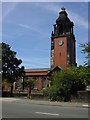
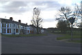
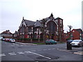
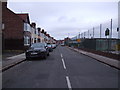
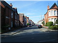

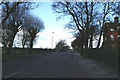
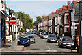
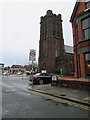
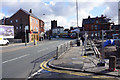
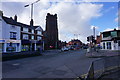
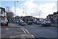
68 photos from this area
Area Information
Key information about the L15 5AZ including its size, population, and administrative classification.
- Area Type
- Postcode
- Area Size
- 5335 m²
- Population
- 1577
- Population Density
- 5909 people/km²
House Prices in L15 5AZ
25
Properties
£202,411
Average Sold Price
£41,250
Lowest Price
£280,500
Highest Price
Showing 25 properties
| Address | Type | Beds | Baths | Last Sale Price | Last Sale Date | |
|---|---|---|---|---|---|---|
| 100 Grant Avenue, Liverpool, L15 5AZ | Terraced | 5 | 1 | £260,000 | Jul 2025 | |
| 96 Grant Avenue, Liverpool, L15 5AZ | Terraced | 3 | 1 | £270,000 | Jun 2025 | |
| 80 Grant Avenue, Liverpool, L15 5AZ | Terraced | 5 | 3 | £220,000 | May 2023 | |
| 98 Grant Avenue, Liverpool, L15 5AZ | Terraced | 4 | 1 | £280,000 | May 2022 | |
| 88 Grant Avenue, Liverpool, L15 5AZ | Terraced | 3 | 1 | £271,500 | Mar 2022 | |
| 82 Grant Avenue, Liverpool, L15 5AZ | house | - | - | £280,500 | Sep 2021 | |
| 84 Grant Avenue, Liverpool, L15 5AZ | Terraced | 3 | - | £247,750 | Jan 2021 | |
| 104 Grant Avenue, Liverpool, L15 5AZ | Terraced | 3 | 2 | £210,000 | Dec 2019 | |
| 72 Grant Avenue, Liverpool, L15 5AZ | Terraced | 3 | 1 | £168,000 | Oct 2018 | |
| 106 Grant Avenue, Liverpool, L15 5AZ | Terraced | - | 1 | £165,000 | Dec 2017 |
Page 1 of 3
Energy Efficiency in L15 5AZ
Amenities
Schools
| Rank | School | Type | Entry gender | Ages |
|---|
Explore more schools in this area
Go to Schools tabDemographics
Household Size
Two person
most common
Accommodation Type
Houses
most common
Tenure
65
majority
Ethnic Group
White
most common
Religion
N/A
most common
Household Composition
N/A
most common
Age
47
median
Adults (30-64 years)
most common
Household Deprivation
N/A
with no deprivation
NS-SEC
41
in Lower managerial occupations
Explore more demographic insights in this area
Go to Demographics tabPlanning
Planning Constraints
- Flood RiskPremium
- Ramsar Wetland SitesPremium
- Area of Outstanding Natural BeautyPremium
- Protected Nature ReservePremium
- Protected WoodlandPremium