Area Overview for L14 9QU
Photos of L14 9QU
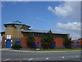
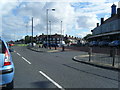
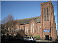
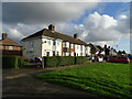
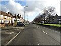
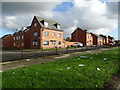
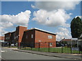
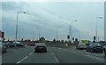
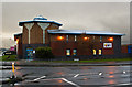
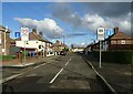

11 photos from this area
Area Information
Key information about the L14 9QU including its size, population, and administrative classification.
- Area Type
- Postcode
- Area Size
- 7898 m²
- Population
- 1514
- Population Density
- 6548 people/km²
House Prices in L14 9QU
28
Properties
£97,994
Average Sold Price
£46,500
Lowest Price
£215,000
Highest Price
Showing 28 properties
| Address | Type | Beds | Baths | Last Sale Price | Last Sale Date | |
|---|---|---|---|---|---|---|
| 8 Crossford Road, Liverpool, L14 9QU | Semi-detached | 2 | 1 | £155,000 | Sep 2025 | |
| 22 Crossford Road, Liverpool, L14 9QU | Detached | 3 | 1 | £215,000 | Jun 2025 | |
| 44 Crossford Road, Liverpool, L14 9QU | Detached | 3 | 2 | £150,000 | Feb 2023 | |
| 28 Crossford Road, Liverpool, L14 9QU | house | 3 | 1 | £160,000 | May 2022 | |
| 52 Crossford Road, Liverpool, L14 9QU | Retail | 3 | 3 | £174,000 | May 2022 | |
| 4 Crossford Road, Liverpool, L14 9QU | Semi-detached | 3 | 1 | £84,950 | Jun 2019 | |
| 48 Crossford Road, Liverpool, L14 9QU | Semi-detached | 3 | 3 | £105,000 | Aug 2017 | |
| 50 Crossford Road, Liverpool, L14 9QU | Semi-detached | 3 | 3 | £90,000 | Aug 2014 | |
| 42 Crossford Road, Liverpool, L14 9QU | Semi-detached | 3 | - | £86,000 | Apr 2014 | |
| 20 Crossford Road, Liverpool, L14 9QU | house | - | - | £97,000 | Jun 2009 |
Page 1 of 3
Energy Efficiency in L14 9QU
Amenities
Schools
| Rank | School | Type | Entry gender | Ages |
|---|
Explore more schools in this area
Go to Schools tabDemographics
Household Size
Family (3-5 people)
most common
Accommodation Type
Houses
most common
Tenure
33
majority
Ethnic Group
White
most common
Religion
N/A
most common
Household Composition
N/A
most common
Age
47
median
Adults (30-64 years)
most common
Household Deprivation
N/A
with no deprivation
NS-SEC
16
in Lower managerial occupations
Explore more demographic insights in this area
Go to Demographics tabPlanning
Planning Constraints
- Flood RiskPremium
- Ramsar Wetland SitesPremium
- Area of Outstanding Natural BeautyPremium
- Protected Nature ReservePremium
- Protected WoodlandPremium