Area Overview for L14 9NH
Photos of L14 9NH
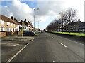
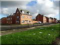
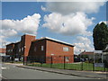
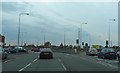
11 photos from this area
Area Information
Key information about the L14 9NH including its size, population, and administrative classification.
- Area Type
- Postcode
- Area Size
- 1.1 hectares
- Population
- 1647
- Population Density
- 8883 people/km²
House Prices in L14 9NH
44
Properties
£71,574
Average Sold Price
£39,450
Lowest Price
£136,000
Highest Price
Showing 44 properties
| Address | Type | Beds | Baths | Last Sale Price | Last Sale Date | |
|---|---|---|---|---|---|---|
| 11 Fincham Road, Liverpool, L14 9NH | Terraced | 2 | 1 | £95,000 | Jun 2024 | |
| 7 Fincham Road, Liverpool, L14 9NH | Semi-detached | 3 | 3 | £136,000 | Oct 2021 | |
| 21 Fincham Road, Liverpool, L14 9NH | house | 3 | 2 | £92,000 | Sep 2021 | |
| 15 Fincham Road, Liverpool, L14 9NH | Semi-detached | 3 | 1 | £78,000 | Mar 2020 | |
| 25 Fincham Road, Liverpool, L14 9NH | Semi-detached | 2 | 1 | £70,000 | Nov 2017 | |
| 81 Fincham Road, Huyton, L14 9NH | Terraced | 3 | 1 | £58,500 | Aug 2017 | |
| 19 Fincham Road, Liverpool, L14 9NH | Semi-detached | 2 | 1 | £58,000 | May 2017 | |
| 55 Fincham Road, Huyton, L14 9NH | house | - | - | £52,500 | Nov 2014 | |
| 87 Fincham Road, Huyton, L14 9NH | Terraced | 3 | 1 | £50,000 | Oct 2014 | |
| 27 Fincham Road, Liverpool, L14 9NH | house | 2 | 2 | £115,000 | Aug 2010 |
Page 1 of 5
Energy Efficiency in L14 9NH
Amenities
Schools
| Rank | School | Type | Entry gender | Ages |
|---|
Explore more schools in this area
Go to Schools tabDemographics
Household Size
Family (3-5 people)
most common
Accommodation Type
Houses
most common
Tenure
71
majority
Ethnic Group
White
most common
Religion
N/A
most common
Household Composition
N/A
most common
Age
47
median
Adults (30-64 years)
most common
Household Deprivation
N/A
with no deprivation
NS-SEC
28
in Lower managerial occupations
Explore more demographic insights in this area
Go to Demographics tabPlanning
Planning Constraints
- Flood RiskPremium
- Ramsar Wetland SitesPremium
- Area of Outstanding Natural BeautyPremium
- Protected Nature ReservePremium
- Protected WoodlandPremium