Area Overview for L13 7DL
Photos of L13 7DL
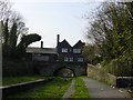

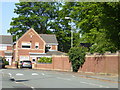
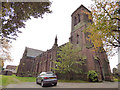
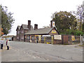
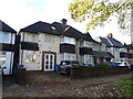
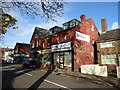
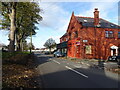
31 photos from this area
Area Information
Key information about the L13 7DL including its size, population, and administrative classification.
- Area Type
- Postcode
- Area Size
- 9541 m²
- Population
- 1386
- Population Density
- 8862 people/km²
House Prices in L13 7DL
65
Properties
£116,213
Average Sold Price
£18,000
Lowest Price
£235,000
Highest Price
Showing 65 properties
| Address | Type | Beds | Baths | Last Sale Price | Last Sale Date | |
|---|---|---|---|---|---|---|
| 116 Moscow Drive, Liverpool, L13 7DL | Terraced | 3 | 1 | £160,550 | Sep 2024 | |
| 148 Moscow Drive, Liverpool, L13 7DL | house | - | - | £180,000 | Aug 2023 | |
| 146 Moscow Drive, Liverpool, L13 7DL | Terraced | 8 | 4 | £182,500 | Jan 2023 | |
| 96 Moscow Drive, Liverpool, L13 7DL | Terraced | 8 | 4 | £110,000 | Dec 2021 | |
| 102 Moscow Drive, Liverpool, L13 7DL | Semi-detached | 2 | 1 | £108,000 | Dec 2017 | |
| 138 Moscow Drive, Liverpool, L13 7DL | Terraced | 6 | 6 | £235,000 | May 2017 | |
| 144 Moscow Drive, Liverpool, L13 7DL | Terraced | - | - | £125,000 | Mar 2016 | |
| 150 Moscow Drive, Liverpool, L13 7DL | Terraced | 7 | - | £150,000 | Mar 2016 | |
| 134 Moscow Drive, Liverpool, L13 7DL | Terraced | 9 | - | £90,000 | Aug 2015 | |
| 140 Moscow Drive, Liverpool, L13 7DL | Terraced | 9 | 3 | £122,000 | Aug 2015 |
Page 1 of 7
Energy Efficiency in L13 7DL
Amenities
Schools
| Rank | School | Type | Entry gender | Ages |
|---|
Explore more schools in this area
Go to Schools tabDemographics
Household Size
Family (3-5 people)
most common
Accommodation Type
Houses
most common
Tenure
78
majority
Ethnic Group
White
most common
Religion
N/A
most common
Household Composition
N/A
most common
Age
47
median
Adults (30-64 years)
most common
Household Deprivation
N/A
with no deprivation
NS-SEC
28
in Lower managerial occupations
Explore more demographic insights in this area
Go to Demographics tabPlanning
Planning Constraints
- Flood RiskPremium
- Ramsar Wetland SitesPremium
- Area of Outstanding Natural BeautyPremium
- Protected Nature ReservePremium
- Protected WoodlandPremium