Area Overview for L13 0AR
Photos of L13 0AR

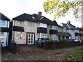
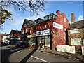
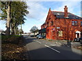
31 photos from this area
Area Information
Key information about the L13 0AR including its size, population, and administrative classification.
- Area Type
- Postcode
- Area Size
- 8478 m²
- Population
- 1386
- Population Density
- 8862 people/km²
House Prices in L13 0AR
7
Properties
£93,000
Average Sold Price
£71,000
Lowest Price
£115,000
Highest Price
Showing 7 properties
| Address | Type | Beds | Baths | Last Sale Price | Last Sale Date | |
|---|---|---|---|---|---|---|
| 426 Queens Drive, West Derby, Liverpool, L13 0AR | Terraced | 3 | - | £71,000 | Nov 2019 | |
| 422 Queens Drive, West Derby, Liverpool, L13 0AR | Retail | - | - | £115,000 | Jul 2006 | |
| Flat 1, 432 Queens Drive, West Derby, Liverpool, L13 0AR | Semi-detached | 3 | 1 | - | - | |
| 424 Queens Drive, West Derby, Liverpool, L13 0AR | house | - | - | - | - | |
| Tesco Express, Tesco Express Supermarket, 418-420 Queens Drive, West Derby, Liverpool, L13 0AR | shop | - | - | - | - | |
| 434A Queens Drive, West Derby, Liverpool, L13 0AR | Flat | - | - | - | - | |
| 428 Queens Drive, West Derby, Liverpool, L13 0AR | house | - | - | - | - |
Energy Efficiency in L13 0AR
Amenities
Schools
| Rank | School | Type | Entry gender | Ages |
|---|
Explore more schools in this area
Go to Schools tabDemographics
Household Size
Family (3-5 people)
most common
Accommodation Type
Houses
most common
Tenure
78
majority
Ethnic Group
White
most common
Religion
N/A
most common
Household Composition
N/A
most common
Age
47
median
Adults (30-64 years)
most common
Household Deprivation
N/A
with no deprivation
NS-SEC
28
in Lower managerial occupations
Explore more demographic insights in this area
Go to Demographics tabPlanning
Planning Constraints
- Flood RiskPremium
- Ramsar Wetland SitesPremium
- Area of Outstanding Natural BeautyPremium
- Protected Nature ReservePremium
- Protected WoodlandPremium