Area Overview for L12 0HG
Photos of L12 0HG

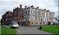
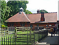
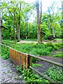
29 photos from this area
Area Information
Key information about the L12 0HG including its size, population, and administrative classification.
- Area Type
- Postcode
- Area Size
- 1.4 hectares
- Population
- 1308
- Population Density
- 2777 people/km²
House Prices in L12 0HG
35
Properties
£186,375
Average Sold Price
£56,500
Lowest Price
£400,000
Highest Price
Showing 35 properties
| Address | Type | Beds | Baths | Last Sale Price | Last Sale Date | |
|---|---|---|---|---|---|---|
| 25 Cumbria Way, Liverpool, L12 0HG | house | - | - | £315,000 | May 2025 | |
| 36 Cumbria Way, Liverpool, L12 0HG | Detached | 4 | 2 | £400,000 | Nov 2022 | |
| 3 Cumbria Way, Liverpool, L12 0HG | house | - | - | £281,000 | Feb 2022 | |
| 7 Cumbria Way, Liverpool, L12 0HG | house | - | - | £170,000 | Apr 2021 | |
| 16 Cumbria Way, Liverpool, L12 0HG | house | - | - | £195,000 | Feb 2018 | |
| 24 Cumbria Way, Liverpool, L12 0HG | Semi-detached | 3 | 1 | £172,000 | Dec 2015 | |
| 26 Cumbria Way, Liverpool, L12 0HG | house | - | - | £160,000 | Oct 2015 | |
| 23 Cumbria Way, Liverpool, L12 0HG | Semi-detached | 3 | 1 | £133,000 | Dec 2014 | |
| 33 Cumbria Way, Liverpool, L12 0HG | house | 3 | - | £160,000 | Jul 2013 | |
| 29 Cumbria Way, Liverpool, L12 0HG | house | - | - | £145,500 | Aug 2011 |
Page 1 of 4
Energy Efficiency in L12 0HG
Amenities
Schools
| Rank | School | Type | Entry gender | Ages |
|---|
Explore more schools in this area
Go to Schools tabDemographics
Household Size
Family (3-5 people)
most common
Accommodation Type
Houses
most common
Tenure
96
majority
Ethnic Group
White
most common
Religion
N/A
most common
Household Composition
N/A
most common
Age
47
median
Adults (30-64 years)
most common
Household Deprivation
N/A
with no deprivation
NS-SEC
35
in Lower managerial occupations
Explore more demographic insights in this area
Go to Demographics tabPlanning
Planning Constraints
- Flood RiskPremium
- Ramsar Wetland SitesPremium
- Area of Outstanding Natural BeautyPremium
- Protected Nature ReservePremium
- Protected WoodlandPremium