Area Overview for L10 6LG
Photos of L10 6LG


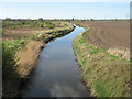


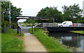
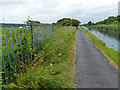


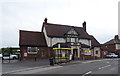
48 photos from this area
Area Information
Key information about the L10 6LG including its size, population, and administrative classification.
- Area Type
- Postcode
- Area Size
- 9537 m²
- Population
- 1444
- Population Density
- 5299 people/km²
House Prices in L10 6LG
26
Properties
£166,750
Average Sold Price
£40,000
Lowest Price
£264,000
Highest Price
Showing 26 properties
| Address | Type | Beds | Baths | Last Sale Price | Last Sale Date | |
|---|---|---|---|---|---|---|
| 172 Altway, Aintree, L10 6LG | house | - | - | £205,000 | Jun 2023 | |
| 140 Altway, Aintree, L10 6LG | house | - | - | £262,000 | Apr 2022 | |
| 136 Altway, Aintree, L10 6LG | Detached | - | - | £249,999 | Dec 2021 | |
| 130 Altway, Aintree, L10 6LG | Detached | 4 | 2 | £264,000 | Oct 2021 | |
| 166 Altway, Aintree, L10 6LG | house | - | - | £153,500 | Jun 2011 | |
| 158 Altway, Aintree, L10 6LG | Semi-detached | - | - | £197,000 | Aug 2007 | |
| 134 Altway, Aintree, L10 6LG | Detached | 4 | 3 | £93,000 | Apr 2004 | |
| 132 Altway, Aintree, L10 6LG | Detached | - | - | £130,000 | Apr 2003 | |
| 150 Altway, Aintree, L10 6LG | Semi-detached | 3 | 1 | £40,000 | Mar 2001 | |
| 144 Altway, Aintree, L10 6LG | Semi-detached | - | - | £73,000 | Aug 1999 |
Page 1 of 3
Energy Efficiency in L10 6LG
Amenities
Schools
| Rank | School | Type | Entry gender | Ages |
|---|
Explore more schools in this area
Go to Schools tabDemographics
Household Size
Two person
most common
Accommodation Type
Houses
most common
Tenure
87
majority
Ethnic Group
White
most common
Religion
N/A
most common
Household Composition
N/A
most common
Age
47
median
Adults (30-64 years)
most common
Household Deprivation
N/A
with no deprivation
NS-SEC
35
in Lower managerial occupations
Explore more demographic insights in this area
Go to Demographics tabPlanning
Planning Constraints
- Flood RiskPremium
- Ramsar Wetland SitesPremium
- Area of Outstanding Natural BeautyPremium
- Protected Nature ReservePremium
- Protected WoodlandPremium