Area Overview for L10 4XR
Photos of L10 4XR
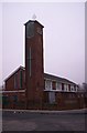

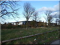
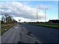
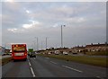


16 photos from this area
Area Information
Key information about the L10 4XR including its size, population, and administrative classification.
- Area Type
- Postcode
- Area Size
- 8921 m²
- Population
- 1308
- Population Density
- 8820 people/km²
House Prices in L10 4XR
27
Properties
£72,029
Average Sold Price
£19,500
Lowest Price
£137,000
Highest Price
Showing 27 properties
| Address | Type | Beds | Baths | Last Sale Price | Last Sale Date | |
|---|---|---|---|---|---|---|
| 192 Elizabeth Road, Field Lane Estate, L10 4XR | Terraced | 3 | 1 | £137,000 | Nov 2024 | |
| 146 Elizabeth Road, Field Lane Estate, L10 4XR | house | - | - | £115,000 | Aug 2024 | |
| 190 Elizabeth Road, Field Lane Estate, L10 4XR | Terraced | 3 | 1 | £115,000 | Nov 2023 | |
| 188 Elizabeth Road, Field Lane Estate, L10 4XR | Terraced | 3 | 1 | £80,000 | Oct 2020 | |
| 150 Elizabeth Road, Field Lane Estate, L10 4XR | Terraced | 2 | 1 | £65,000 | Nov 2017 | |
| 172 Elizabeth Road, Field Lane Estate, L10 4XR | Terraced | 3 | 1 | £100,000 | Apr 2017 | |
| 148 Elizabeth Road, Field Lane Estate, L10 4XR | house | 2 | - | £65,000 | Nov 2013 | |
| 170 Elizabeth Road, Field Lane Estate, L10 4XR | house | - | - | £75,000 | Sep 2013 | |
| 142 Elizabeth Road, Field Lane Estate, L10 4XR | house | - | - | £65,666 | Jun 2006 | |
| 156 Elizabeth Road, Field Lane Estate, L10 4XR | house | - | - | £65,666 | May 2006 |
Page 1 of 3
Energy Efficiency in L10 4XR
Amenities
Schools
| Rank | School | Type | Entry gender | Ages |
|---|
Explore more schools in this area
Go to Schools tabDemographics
Household Size
Two person
most common
Accommodation Type
Houses
most common
Tenure
63
majority
Ethnic Group
White
most common
Religion
N/A
most common
Household Composition
N/A
most common
Age
47
median
Adults (30-64 years)
most common
Household Deprivation
N/A
with no deprivation
NS-SEC
18
in Lower managerial occupations
Explore more demographic insights in this area
Go to Demographics tabPlanning
Planning Constraints
- Flood RiskPremium
- Ramsar Wetland SitesPremium
- Area of Outstanding Natural BeautyPremium
- Protected Nature ReservePremium
- Protected WoodlandPremium