Area Overview for L10 4XP
Photos of L10 4XP
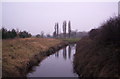

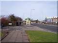
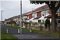
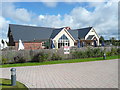


21 photos from this area
Area Information
Key information about the L10 4XP including its size, population, and administrative classification.
- Area Type
- Postcode
- Area Size
- 1.4 hectares
- Population
- 1308
- Population Density
- 8820 people/km²
House Prices in L10 4XP
45
Properties
£85,465
Average Sold Price
£35,000
Lowest Price
£145,000
Highest Price
Showing 45 properties
| Address | Type | Beds | Baths | Last Sale Price | Last Sale Date | |
|---|---|---|---|---|---|---|
| 136 Elizabeth Road, Field Lane Estate, L10 4XP | Detached | 2 | 1 | £103,000 | May 2025 | |
| 58 Elizabeth Road, Field Lane Estate, L10 4XP | house | - | - | £130,000 | Oct 2024 | |
| 98 Elizabeth Road, Field Lane Estate, L10 4XP | Semi-detached | 3 | 1 | £140,000 | Aug 2024 | |
| 94 Elizabeth Road, Field Lane Estate, L10 4XP | Semi-detached | 3 | 1 | £72,000 | Dec 2023 | |
| 52 Elizabeth Road, Field Lane Estate, L10 4XP | Semi-detached | 3 | 1 | £145,000 | Sep 2023 | |
| 54 Elizabeth Road, Field Lane Estate, L10 4XP | Semi-detached | 3 | 1 | £117,000 | Jul 2022 | |
| 120 Elizabeth Road, Field Lane Estate, L10 4XP | Semi-detached | 3 | 1 | £137,500 | Sep 2020 | |
| 66 Elizabeth Road, Field Lane Estate, L10 4XP | Semi-detached | 3 | 1 | £95,000 | Jul 2019 | |
| 106 Elizabeth Road, Field Lane Estate, L10 4XP | Semi-detached | 3 | 1 | £115,000 | Dec 2018 | |
| 60 Elizabeth Road, Field Lane Estate, L10 4XP | Semi-detached | 3 | 1 | £80,000 | Oct 2018 |
Page 1 of 5
Energy Efficiency in L10 4XP
Amenities
Schools
| Rank | School | Type | Entry gender | Ages |
|---|
Explore more schools in this area
Go to Schools tabDemographics
Household Size
Two person
most common
Accommodation Type
Houses
most common
Tenure
63
majority
Ethnic Group
White
most common
Religion
N/A
most common
Household Composition
N/A
most common
Age
47
median
Adults (30-64 years)
most common
Household Deprivation
N/A
with no deprivation
NS-SEC
18
in Lower managerial occupations
Explore more demographic insights in this area
Go to Demographics tabPlanning
Planning Constraints
- Flood RiskPremium
- Ramsar Wetland SitesPremium
- Area of Outstanding Natural BeautyPremium
- Protected Nature ReservePremium
- Protected WoodlandPremium