Area Overview for L10 3LJ
Photos of L10 3LJ
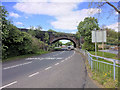
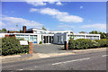
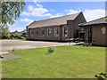
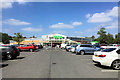
40 photos from this area
Area Information
Key information about the L10 3LJ including its size, population, and administrative classification.
- Area Type
- Postcode
- Area Size
- 9798 m²
- Population
- 1300
- Population Density
- 2169 people/km²
House Prices in L10 3LJ
26
Properties
£129,723
Average Sold Price
£54,500
Lowest Price
£225,000
Highest Price
Showing 26 properties
| Address | Type | Beds | Baths | Last Sale Price | Last Sale Date | |
|---|---|---|---|---|---|---|
| 45 Lincoln Drive, Aintree, L10 3LJ | Semi-detached | 3 | - | £225,000 | Apr 2022 | |
| 43 Lincoln Drive, Aintree, L10 3LJ | house | - | - | £166,000 | Apr 2021 | |
| 41 Lincoln Drive, Aintree, L10 3LJ | Semi-detached | 3 | 1 | £130,000 | Sep 2020 | |
| 21 Lincoln Drive, Aintree, L10 3LJ | Semi-detached | 3 | - | £131,000 | Nov 2016 | |
| 11 Lincoln Drive, Aintree, L10 3LJ | Semi-detached | 3 | - | £157,000 | Jul 2016 | |
| 51 Lincoln Drive, Aintree, L10 3LJ | Terraced | 3 | - | £150,000 | Sep 2014 | |
| 9 Lincoln Drive, Aintree, L10 3LJ | house | - | - | £124,999 | Jan 2014 | |
| 7 Lincoln Drive, Aintree, L10 3LJ | house | - | - | £122,000 | Feb 2013 | |
| 29 Lincoln Drive, Aintree, L10 3LJ | Flat | - | - | £89,500 | Jan 2008 | |
| 33 Lincoln Drive, Aintree, L10 3LJ | Flat | - | - | £54,500 | Jun 2003 |
Page 1 of 3
Energy Efficiency in L10 3LJ
Amenities
Schools
| Rank | School | Type | Entry gender | Ages |
|---|
Explore more schools in this area
Go to Schools tabDemographics
Household Size
Family (3-5 people)
most common
Accommodation Type
Houses
most common
Tenure
78
majority
Ethnic Group
White
most common
Religion
N/A
most common
Household Composition
N/A
most common
Age
47
median
Adults (30-64 years)
most common
Household Deprivation
N/A
with no deprivation
NS-SEC
27
in Lower managerial occupations
Explore more demographic insights in this area
Go to Demographics tabPlanning
Planning Constraints
- Flood RiskPremium
- Ramsar Wetland SitesPremium
- Area of Outstanding Natural BeautyPremium
- Protected Nature ReservePremium
- Protected WoodlandPremium