Area Overview for L10 2LF
Photos of L10 2LF
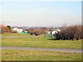
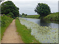
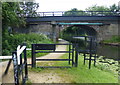
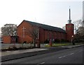
39 photos from this area
Area Information
Key information about the L10 2LF including its size, population, and administrative classification.
- Area Type
- Postcode
- Area Size
- 1.7 hectares
- Population
- 1360
- Population Density
- 4242 people/km²
House Prices in L10 2LF
22
Properties
£167,238
Average Sold Price
£68,000
Lowest Price
£247,500
Highest Price
Showing 22 properties
| Address | Type | Beds | Baths | Last Sale Price | Last Sale Date | |
|---|---|---|---|---|---|---|
| 68 Shrewsbury Avenue, Aintree, L10 2LF | house | - | - | £247,500 | Mar 2023 | |
| 42 Shrewsbury Avenue, Aintree, L10 2LF | house | - | - | £198,000 | Jul 2022 | |
| 34 Shrewsbury Avenue, Aintree, L10 2LF | house | 3 | - | £215,000 | Feb 2020 | |
| 66 Shrewsbury Avenue, Aintree, L10 2LF | Semi-detached | 3 | - | £169,950 | Jul 2016 | |
| 36 Shrewsbury Avenue, Aintree, L10 2LF | house | - | - | £182,500 | Aug 2014 | |
| 52 Shrewsbury Avenue, Aintree, L10 2LF | house | 3 | - | £169,000 | Jan 2013 | |
| 48 Shrewsbury Avenue, Aintree, L10 2LF | Semi-detached | - | - | £87,950 | May 2002 | |
| 64 Shrewsbury Avenue, Aintree, L10 2LF | Semi-detached | 3 | - | £68,000 | Dec 2000 | |
| 38 Shrewsbury Avenue, Aintree, L10 2LF | Semi-detached | - | - | - | - | |
| 32 Shrewsbury Avenue, Aintree, L10 2LF | Terraced | - | - | - | - |
Page 1 of 3
Energy Efficiency in L10 2LF
Amenities
Schools
| Rank | School | Type | Entry gender | Ages |
|---|
Explore more schools in this area
Go to Schools tabDemographics
Household Size
Two person
most common
Accommodation Type
Houses
most common
Tenure
90
majority
Ethnic Group
White
most common
Religion
N/A
most common
Household Composition
N/A
most common
Age
47
median
Adults (30-64 years)
most common
Household Deprivation
N/A
with no deprivation
NS-SEC
31
in Lower managerial occupations
Explore more demographic insights in this area
Go to Demographics tabPlanning
Planning Constraints
- Flood RiskPremium
- Ramsar Wetland SitesPremium
- Area of Outstanding Natural BeautyPremium
- Protected Nature ReservePremium
- Protected WoodlandPremium