Area Overview for L10 1LU
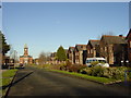
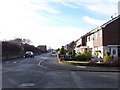
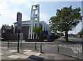
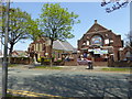
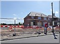
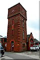
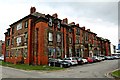
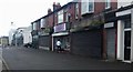
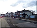
Photos of L10 1LU

Area Information
Living in L10 1LU means residing in a tightly clustered residential zone defined by a specific postcode. This area covers 8538 square metres and accommodates a population of 1809 people. The density is high, reaching 211872 people per square kilometre, which creates a compact living environment close to the ground. You are looking at a hyper-localised setting where neighbours are literally steps away from one another. The location forms a small residential cluster rather than a sprawling suburb. This concentration means your daily commute or local walk takes up less physical space but involves constant proximity to others. You exist within a distinct geographical boundary that separates this cluster from surrounding districts. The area functions as a focused hub for local interaction within the larger Fazakerley context. Homebuyers here enter a micro-community where the boundaries are physically tight and the community operates with intense frequency.
- Area Type
- Postcode
- Area Size
- 8538 m²
- Population
- 1809
- Population Density
- 4239 people/km²
The property market in L10 1LU is characterised by a high volume of houses rather than flats or apartments. With 53% of households owning their homes, this represents a majority owner-occupied market. This statistic suggests that long-term residents have put down roots in the area and are unlikely to relocate frequently. The remaining 47% of households are rented, creating a mixed market where buying and renting coexist. Because the accommodation type is explicitly listed as houses, you should expect stock that includes semi-detached or detached properties suitable for families. This postcode operates as a small residential cluster where property values are likely influenced by the specific demand for house ownership. Buyers looking for flats in this immediate cluster may find fewer options compared to larger urban centres. The prevalence of home ownership points towards a stable market where sellers are often keen on part-exchange or moving upwards. You are entering a market defined by permanent housing stock rather than transient renting.
House Prices in L10 1LU
Showing 23 properties
| Address | Type | Beds | Baths | Last Sale Price | Last Sale Date | |
|---|---|---|---|---|---|---|
| 94 Haven Road, Liverpool, L10 1LU | house | - | - | £115,000 | Jul 2021 | |
| 90 Haven Road, Liverpool, L10 1LU | Terraced | 3 | - | £71,000 | Jan 2016 | |
| 96 Haven Road, Liverpool, L10 1LU | Terraced | - | - | £85,000 | Aug 2007 | |
| 92 Haven Road, Liverpool, L10 1LU | house | - | - | £100,000 | Jan 2007 | |
| 74 Haven Road, Liverpool, L10 1LU | Terraced | - | - | £44,950 | May 2003 | |
| 110 Haven Road, Liverpool, L10 1LU | Terraced | - | - | £35,000 | Dec 2002 | |
| 76 Haven Road, Liverpool, L10 1LU | house | - | - | £17,250 | Feb 1997 | |
| 80 Haven Road, Liverpool, L10 1LU | Bungalow | - | - | - | - | |
| 78 Haven Road, Liverpool, L10 1LU | Bungalow | - | - | - | - | |
| 82 Haven Road, Liverpool, L10 1LU | Bungalow | - | - | - | - |
Energy Efficiency in L10 1LU
Residents of L10 1LU have access to specific retail and transport hubs within practical reach. Tesco Fazakerley and Aldi Fazakerley provide comprehensive grocery shopping options for your weekly food requirements. Co-op Copplehouse offers a choice for smaller stores or convenience needs. Five railway stations serve the wider area, with Fazakerley Railway Station, Kirkby Railway Station, and Aintree Railway Station being the nearest major nodes. These stations facilitate easy travel to Liverpool city centre or other towns. Three ferry terminals are also within reach, including Liverpool Belfast Ferry Terminal Bootle, Liverpool Isle of Man and Dublin Terminal, and Liverpool Pier Head Ferry Terminal. These connections enable travel across Ireland and to Europe for those requiring international journeys. Your lifestyle benefits from a variety of transport modes and shopping locations. You can grab morning coffee or fresh produce without driving far. The proximity to major rail hubs and ferries adds significant value to your daily routine.
Amenities
Schools
There are several educational institutions within practical reach of L10 1LU, offering varied specialisations. Fazakerley Infant School and Fazakerley Junior School provide primary education for younger children. Fazakerley High School stands nearby as another primary option, though its naming convention typically mirrors the infant and junior phases. Meadow Bank School operates as a special school, catering to specific educational needs within the local vicinity. Brookside Pupil Referral Unit sits among these options, serving a different student demographic requiring alternative schooling arrangements. Families in this postcode have access to a mix of standard and special provision schools. The presence of multiple schools indicates that the surrounding area supports educational needs beyond a single institution. You may find yourself commuting to a local primary school or selecting a school further away depending on your children's ages. The cluster of schools near L10 1LU offers a range of entry points for education.
| Rank | School | Type | Entry gender | Ages |
|---|
Explore more schools in this area
Go to Schools tabDemographics
The community in L10 1LU is dominated by adults between the ages of 30 and 64 years. The median age across this postcode is 47, indicating a mature population. Most residents have passed their thirtieth birthday and are likely established in their careers or caring for older family members. House ownership stands at 53%, showing that just over half of the households own their homes outright or with a mortgage. The remaining 47% likely rent their accommodation. The dominant housing type consists of houses rather than flats or terraced units, suggesting families or couples established themselves in standalone properties. The demographic breakdown is predominantly White, reflecting the broader Northern England profile of the area. This age structure influences local services as a 47-year-old median resident prioritises reliability and established neighbourhoods over rapid development. You are buying into a stable demographic where the majority of residents fall within the working and pre-retirement years.
Household Size
Accommodation Type
Tenure
Ethnic Group
Religion
Household Composition
Age
Household Deprivation
NS-SEC
Explore more demographic insights in this area
Go to Demographics tabPlanning
Planning Constraints
- Flood RiskPremium
- Ramsar Wetland SitesPremium
- Area of Outstanding Natural BeautyPremium
- Protected Nature ReservePremium
- Protected WoodlandPremium