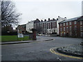
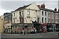
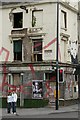
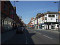
Area Overview for L1 9AR
Photos of L1 9AR


Area Information
Liverpool's L1 9AR postcode occupies a compact residential cluster covering just 2,897 square metres. This small footprint results in an extremely high population density of 503,353 people per square kilometre, meaning residents live in a tightly packed urban environment. The average household here is defined by proximity rather than space, creating a neighbourhood where daily life revolves within a few metres of your home. This specific area forms part of the larger city centre tapestry, blending the density typical of major UK cities with the intimate feel of a small estate. Living in L1 9AR means accepting a high-rise, high-density lifestyle in exchange for unparalleled urban convenience. You will find yourself surrounded by millions of other residents in the Liverpool region, which offers a dynamic energy distinct from more suburban locations. The area is characterised by its condensed nature, making it an ideal choice for those who prioritise walking distances to transport links and services over private garden space. Every aspect of existence here is scaled to the footprint of the postcodes surrounding it, from the speed of your morning commute to the variety of shops accessible within minutes.
- Area Type
- Postcode
- Area Size
- 2897 m²
- Population
- 1458
- Population Density
- 9980 people/km²
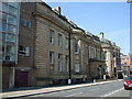
The housing stock in L1 9AR is overwhelmingly dominated by flats, a fact confirmed by the predominant accommodation type data. With only 22% of households owning their property, the area functions as a high-paid rental market rather than a traditional owner-occupied neighbourhood. This suggests that the bulk of the 1,458 residents live in properties rented from private landlords or through housing associations. You will find very few free-standing houses or detached properties within this specific 2,897 square metre postcode. The market is driven by demand from young adults aged 15 to 29 who require low-maintenance living spaces close to city centre employment hubs. Potential buyers looking for permanent residence should note that purchasing a balcony or top-floor flat may be the only route to ownership. The high population density of 503,353 people per square kilometre reinforces the urban, high-rise character of the housing. This environment suits those who prefer the convenience of city living over the space of suburban housing. The scarcity of owned homes indicates a competitive short-term rental market for tenants.
House Prices in L1 9AR
Showing 30 properties
| Address | Type | Beds | Baths | Last Sale Price | Last Sale Date | |
|---|---|---|---|---|---|---|
| Flat 1, 84 Rodney Street, Liverpool, L1 9AR | Flat | - | - | - | - | |
| Micrah Services Ltd, 88 Rodney Street, Liverpool, L1 9AR | Flat | - | - | - | - | |
| 86 Rodney Street, Liverpool, L1 9AR | Terraced | - | - | - | - | |
| Merseyside Aids Support Group, 80 Rodney Street, Liverpool, L1 9AR | commercial | - | - | - | - | |
| 82 Rodney Street, Liverpool, L1 9AR | house | - | - | - | - | |
| Gp Surgery, 88 Rodney Street, Liverpool, L1 9AR | commercial | - | - | - | - | |
| Second Floor Flat, 88 Rodney Street, Liverpool, L1 9AR | Unknown | - | - | - | - | |
| First Floor, 78 Rodney Street, Liverpool, L1 9AR | Office | - | - | - | - | |
| Basement, 78 Rodney Street, Liverpool, L1 9AR | Office | - | - | - | - | |
| Second Floor, 78 Rodney Street, Liverpool, L1 9AR | Office | - | - | - | - |
Energy Efficiency in L1 9AR
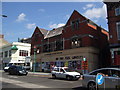
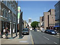
Daily life for residents of L1 9AR is anchored by a comprehensive network of retail, rail, and ferry amenities within practical reach. For shopping needs, the Co-op Leece store and outlets at Tesco Liverpool and Co-op Liverpool are situated close by, providing access to groceries and daily essentials. Commuters rely heavily on the local rail infrastructure, with five stations including Liverpool Lime Street Low Level Railway Station and Liverpool James Street Railway Station facilitating regular journeys. Sea travel is equally accessible via the Woodside Birkenhead Ferry Terminal and the Liverpool Pier Head Ferry Terminal, offering links to destinations like Isle of Man and Dublin. This concentration of five ferry terminals near the postcode highlights the strategic importance of this location for regional travel. The area's immediate vicinity supports a self-sufficient lifestyle where work, education, and leisure are all within walking distance. You can access dining and services without needing a car for most errands. The presence of these major transport hubs transforms the area into a central node for the city. Living here grants you immediate access to the full spectrum of public and private transport options available in Liverpool.
Amenities
Schools
Families considering living in L1 9AR have access to a mix of educational institutions within practical reach. The primary independent option for private education is the Elliott-Clarke School, recognised for its distinctive curriculum and educational approach. For those opting for state education, Lipa School stands out as an academy with a satisfactory Ofsted rating. This school operates under the academy model, allowing for greater autonomy over its educational methods. City College is also available nearby, offering further education and vocational training alongside the other establishments. The presence of an academy with a satisfactory rating ensures that government standards for teaching quality are met. While the catchment area for Key Stage 2 SATs is not detailed in this specific data snippet, the mix of school types provides choices for different educational philosophies. The proximity of these schools supports young adults and families in the 15 to 29 age bracket who are in or nearing their education phase. The combination of independent and state provision offers a balanced range of schooling options for the surrounding neighbourhood.
| Rank | School | Type | Entry gender | Ages |
|---|
Explore more schools in this area
Go to Schools tabDemographics
The community within L1 9AR is defined by a very young population, with a median age of just 22 years. Data indicates that the most common age range consists of young adults, meaning those aged between 15 and 29 years dominate the local demographic profile. This youthful skew results in a population of 1,458 individuals living in a space significantly smaller than the national average. Consequently, the area serves primarily as a rental market rather than a location for older families seeking retirement housing or established community roots. Only 22% of residents own their homes, leaving nearly four out of every five households in rented accommodation. This low ownership rate reflects the transient nature of the area, attracting students and young professionals seeking affordable city living. The demographic composition remains overwhelmingly White, mirroring the broader patterns of the Liverpool area. This high concentration of young renters creates a vibrant, fluid community where residents often move frequently. The accommodation type is almost exclusively flats, catering to single occupants and couples who need efficient living spaces.
Household Size
Accommodation Type
Tenure
Ethnic Group
Religion
Household Composition
Age
Household Deprivation
NS-SEC
Explore more demographic insights in this area
Go to Demographics tabPlanning
Planning Constraints
- Flood RiskPremium
- Ramsar Wetland SitesPremium
- Area of Outstanding Natural BeautyPremium
- Protected Nature ReservePremium
- Protected WoodlandPremium