Area Overview for L1 7AZ
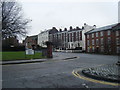
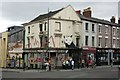
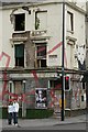
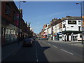
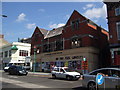
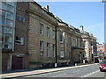
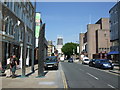
Photos of L1 7AZ


Area Information
Living in L1 7AZ means being part of a densely populated, compact residential cluster in England’s north-west. The area covers just 4.1 hectares, yet it is home to 2,547 people, making it one of the most densely populated places in the UK at 61,460 people per square kilometre. This small postcode area is characterised by a young demographic, with a median age of 22 and the majority of residents aged between 15 and 29. The housing stock is predominantly flats, reflecting a community where owner-occupation is rare — only 16% of homes are owned by residents. Daily life here is shaped by proximity to Liverpool’s urban infrastructure, with easy access to rail, ferry, and retail networks. While the area lacks green spaces or natural constraints, its compact size ensures amenities are within walking distance. However, the high population density and transient population suggest a focus on convenience over spacious living. For those seeking a central, active lifestyle with limited space but strong connectivity, L1 7AZ offers a distinct, fast-paced environment.
- Area Type
- Postcode
- Area Size
- 4.1 hectares
- Population
- 2547
- Population Density
- 9710 people/km²
The property market in L1 7AZ is dominated by rental flats, with only 16% of homes owned by residents. This indicates a heavily rented market, likely catering to students, temporary workers, or those seeking short-term accommodation. The absence of larger homes or owner-occupied properties suggests limited appeal for families or long-term buyers. Given the area’s small size and high population density, the housing stock is constrained, with little scope for expansion. For buyers, this means opportunities are rare, and any available properties are likely to be flats in multi-unit buildings. The lack of owner-occupation also implies a transient population, with little incentive for long-term investment. Those considering the area should focus on rental yields or short-term lets, though the market’s narrow focus on flats may limit options for those seeking alternative housing types.
House Prices in L1 7AZ
No properties found in this postcode.
Energy Efficiency in L1 7AZ
Life in L1 7AZ is shaped by its proximity to essential amenities. The area’s retail options include Co-op Liverpool, Co-op Leece, and Tesco Liverpool, ensuring everyday shopping needs are met within walking distance. Rail stations like Liverpool Central Loop Line and Liverpool Lime Street provide easy access to the city’s cultural and commercial hubs, while ferry terminals at Pier Head and Woodside Birkenhead connect residents to surrounding areas. Though the area lacks parks or leisure spaces, its compact size ensures amenities are conveniently located. The presence of multiple retail outlets and transport links suggests a practical, urban lifestyle focused on accessibility over expansive living. For those prioritising convenience over open spaces, L1 7AZ offers a streamlined, connected environment.
Amenities
Schools
Residents of L1 7AZ have access to three distinct educational institutions within practical reach. The Royal Liverpool Children’s Hospital School is a special school, catering to students with specific needs. Nearby, the Liverpool Institute of Performing Arts offers a unique focus on arts and performance, while LIPA Sixth Form College provides post-16 education. This mix of school types suggests a community with diverse educational priorities, from specialist support to vocational training. However, the absence of primary or secondary schools in the immediate area means families may need to look further afield for comprehensive schooling. The presence of a sixth-form college and a performing arts institution indicates a potential draw for students pursuing non-traditional education paths, though it may not meet the needs of all families.
| Rank | School | Type | Entry gender | Ages |
|---|
Explore more schools in this area
Go to Schools tabDemographics
The community in L1 7AZ is overwhelmingly young, with a median age of 22 and 82% of residents falling within the 15–29 age range. This suggests a population skewed towards students, recent graduates, or those in transient employment. Home ownership is exceptionally low at 16%, indicating that the majority of residents rent their accommodation. The area’s housing stock is almost entirely composed of flats, reflecting a lack of traditional family homes or larger properties. The predominant ethnic group is White, though no specific data on diversity or deprivation is provided. The high proportion of young adults implies a dynamic, possibly student-driven community, though the absence of family-oriented housing may limit long-term residency. The demographic profile suggests a focus on short-term living, with residents likely prioritising proximity to urban amenities over long-term stability.
Household Size
Accommodation Type
Tenure
Ethnic Group
Religion
Household Composition
Age
Household Deprivation
NS-SEC
Explore more demographic insights in this area
Go to Demographics tabPlanning
Planning Constraints
- Flood RiskPremium
- Ramsar Wetland SitesPremium
- Area of Outstanding Natural BeautyPremium
- Protected Nature ReservePremium
- Protected WoodlandPremium