Area Overview for Salford
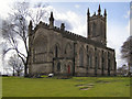
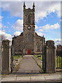
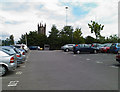
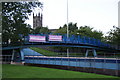
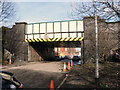
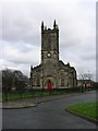
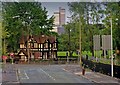
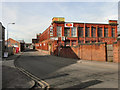
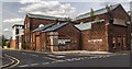
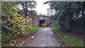
Photos of Salford

Area Information
Salford is a compact built-up area spanning 17.5 km², home to 15,066 residents. Its population density of 859 people per square kilometre reflects a tightly knit urban environment, typical of Greater Manchester’s inner areas. The city’s proximity to Manchester offers easy access to a major urban hub, while its own local amenities provide a self-contained lifestyle. Daily life here is shaped by a mix of historic and modern infrastructure, with a focus on connectivity and accessibility. Salford’s character is defined by its blend of residential and commercial spaces, though the high median age of 70 suggests a community leaning towards older residents. This demographic profile influences local services and social dynamics, creating a distinct rhythm to the area’s pace of life. For buyers, Salford presents a compact, well-connected option with proximity to transport networks and a range of nearby facilities. However, its small size means residents must balance convenience with the limitations of a dense urban footprint.
- Area Type
- Built Up Area 250
- Area Size
- 17.5 km²
- Population
- 15066
- Population Density
- 859 people/km²
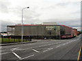
Salford’s lifestyle is supported by a range of nearby amenities. Retail options include Iceland Salford, Heron Pendleton, and Tesco Salford, offering everyday shopping needs. The area’s rail and metro stations provide easy access to Manchester’s cultural and commercial hubs, while the nearby Chorlton Street Coach Station connects to surrounding suburbs. Manchester City Airport’s proximity adds to the area’s appeal for frequent travelers. For leisure, the mix of urban and transport infrastructure suggests opportunities for dining, entertainment, and local events. While specific parks or recreational spaces are not listed, the area’s density and connectivity imply a focus on convenience over expansive green spaces. Residents can enjoy a blend of practicality and urban vibrancy, though the compact footprint may limit options for outdoor activities.
Amenities
Schools
Salford’s nearby schools include a mix of independent and nursery institutions. The Manchester Jewish Grammar School is an independent school, while King of Kings, an independent school with a satisfactory Ofsted rating, provides another option for families. Three nursery schools—Hulme Street, Kara Street, and London Street—cater to younger children. The presence of independent schools suggests a range of educational choices, though the Ofsted rating for King of Kings indicates room for improvement in standards. For families prioritising state education, the data does not include local state schools, but the nursery options offer early years support. The mix of school types reflects a community where educational preferences vary, though the limited data means a full picture of school quality remains incomplete.
| Rank | School | Type | Entry gender | Ages |
|---|
Explore more schools in this area
Go to Schools tabDemographics
Salford’s population has a median age of 70, the highest in the UK, indicating a community skewed towards older adults. This age profile shapes the area’s social and economic landscape, with services and amenities tailored to older residents. Home ownership here is relatively low, at 33%, suggesting a rental-dominated market. The data does not specify household composition or accommodation types, but the overall population density implies a mix of housing stock. The lack of detailed demographic breakdowns on ethnicity or religion means the area’s cultural diversity remains unquantified. However, the high median age and moderate population size suggest a community focused on stability and established living. For buyers, this demographic context may influence property demand, with older residents potentially prioritising accessibility and proximity to healthcare services.