Area Overview for Rochdale
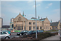
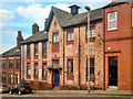
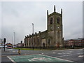
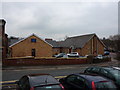
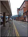
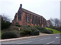
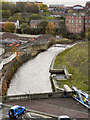
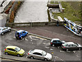
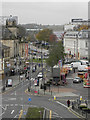
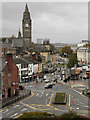
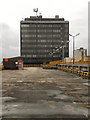
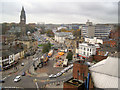
Photos of Rochdale
Area Information
Rochdale is a built-up area in England covering 25.4 km², home to 34,100 residents. With a population density of 1,345 people per square kilometre, it is a compact, densely populated town where daily life is shaped by its proximity to urban amenities. The area’s character is defined by its mix of retail, transport hubs, and community spaces, making it practical for those prioritising convenience. While the median age of 70 suggests a community skewed towards older residents, Rochdale offers a range of services to support all age groups. Its central location, with multiple railway stations and a bustling town centre, ensures easy access to surrounding areas. For buyers, Rochdale balances affordability with accessibility, though its demographic profile may appeal more to those seeking a quieter, established environment over a rapidly growing one. The town’s infrastructure, from broadband connectivity to public transport, supports both working professionals and retirees alike.
- Area Type
- Built Up Area 250
- Area Size
- 25.4 km²
- Population
- 34100
- Population Density
- 1345 people/km²
Residents of Rochdale have access to a range of amenities within practical reach. Retail options include major stores such as Asda Rochdale, Aldi Mellor, and Iceland Market, catering to everyday shopping needs. The town’s metro points, including Rochdale Town Centre and Newbold, offer a mix of commercial and leisure spaces. Rail stations like Rochdale Railway Station provide links to surrounding areas, enhancing mobility. While the data does not specify parks or leisure facilities, the presence of multiple retail and transport hubs suggests a focus on convenience over expansive green spaces. The area’s compact layout ensures that essential services are within walking or short driving distance, supporting a lifestyle that prioritises accessibility and practicality.
Amenities
Schools
Rochdale’s educational landscape includes five nursery schools: Brimrod Nursery School, Howard Street Nursery School, South Street Nursery School, Thames Street Nursery School, and Brimrod Community Primary School. The latter is a primary school with a 'good' Ofsted rating, offering families a reliable option for early education. The presence of multiple nurseries suggests a focus on early childhood development, though secondary schools are not listed in the data. For parents, the combination of nursery and primary schooling within the area provides convenience, though further details on school performance or capacity are not available. The 'good' rating at Brimrod Community Primary School indicates a baseline standard of education, but prospective families may need to seek additional information on secondary options.
| Rank | A + A* % | School | Type | Entry gender | Ages |
|---|---|---|---|---|---|
| 1 | N/A | Brimrod Nursery School | nursery | N/A | N/A |
| 2 | N/A | Howard Street Nursery School | nursery | N/A | N/A |
| 3 | N/A | South Street Nursery School | nursery | N/A | N/A |
| 4 | N/A | Thames Street Nursery School | nursery | N/A | N/A |
| 5 | N/A | Brimrod Community Primary School | primary | N/A | N/A |
Explore more schools in this area
Go to Schools tabDemographics
Rochdale’s population includes a median age of 70, indicating a community where older residents form a significant proportion. The home ownership rate stands at 61%, suggesting a stable housing market with a notable presence of owner-occupied properties. While the data does not specify household composition or predominant accommodation types, the high population density implies a mix of family homes, flats, and other housing forms. The area’s demographic profile, with no specific ethnic or religious breakdown provided, reflects a broad diversity typical of many urban centres. However, the lack of detailed data on deprivation or socioeconomic factors means that quality of life assessments must rely on available metrics. The presence of 5 nursery schools and a primary school with a 'good' Ofsted rating suggests efforts to support families, though further details on educational outcomes or community services are not available.
Household Size
Accommodation Type
Tenure
Ethnic Group
Religion
Household Composition
Age
Household Deprivation
NS-SEC
Explore more demographic insights in this area
Go to Demographics tabPlanning
Planning Constraints
- Crime RiskLocked