Area Overview for FY5 2LH
Photos of FY5 2LH
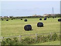

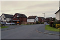
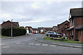
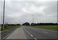


13 photos from this area
Area Information
Key information about the FY5 2LH including its size, population, and administrative classification.
- Area Type
- Postcode
- Area Size
- 2.8 hectares
- Population
- 1469
- Population Density
- 1114 people/km²
House Prices in FY5 2LH
42
Properties
£123,923
Average Sold Price
£36,000
Lowest Price
£205,000
Highest Price
Showing 42 properties
| Address | Type | Beds | Baths | Last Sale Price | Last Sale Date | |
|---|---|---|---|---|---|---|
| 51 Northumberland Avenue, Thornton Cleveleys, FY5 2LH | Bungalow | 1 | 1 | £115,000 | Nov 2024 | |
| 42 Northumberland Avenue, Thornton Cleveleys, FY5 2LH | Bungalow | 2 | 1 | £127,500 | Jun 2024 | |
| 34 Northumberland Avenue, Thornton Cleveleys, FY5 2LH | Semi-detached | 3 | 1 | £129,950 | May 2024 | |
| 47 Northumberland Avenue, Thornton Cleveleys, FY5 2LH | Bungalow | 1 | 2 | £146,000 | Mar 2024 | |
| 43 Northumberland Avenue, Thornton Cleveleys, FY5 2LH | Bungalow | 3 | 1 | £205,000 | Feb 2024 | |
| 72 Northumberland Avenue, Thornton Cleveleys, FY5 2LH | Bungalow | 2 | 1 | £185,000 | Jan 2023 | |
| 39 Northumberland Avenue, Thornton Cleveleys, FY5 2LH | Bungalow | 3 | 2 | £160,000 | Nov 2022 | |
| 58 Northumberland Avenue, Thornton Cleveleys, FY5 2LH | house | - | - | £155,000 | May 2021 | |
| 55 Northumberland Avenue, Thornton Cleveleys, FY5 2LH | Bungalow | - | - | £90,000 | Aug 2020 | |
| 56 Northumberland Avenue, Thornton Cleveleys, FY5 2LH | Semi-detached | 4 | 1 | £182,000 | Apr 2018 |
Page 1 of 5
Energy Efficiency in FY5 2LH
Amenities
Schools
| Rank | School | Type | Entry gender | Ages |
|---|
Explore more schools in this area
Go to Schools tabDemographics
Household Size
Two person
most common
Accommodation Type
Houses
most common
Tenure
85
majority
Ethnic Group
White
most common
Religion
N/A
most common
Household Composition
N/A
most common
Age
47
median
Adults (30-64 years)
most common
Household Deprivation
N/A
with no deprivation
NS-SEC
32
in Lower managerial occupations
Explore more demographic insights in this area
Go to Demographics tabPlanning
Planning Constraints
- Flood RiskPremium
- Ramsar Wetland SitesPremium
- Area of Outstanding Natural BeautyPremium
- Protected Nature ReservePremium
- Protected WoodlandPremium