Area Overview for CW9 8AY
Photos of CW9 8AY

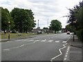
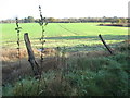
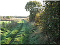
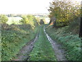
7 photos from this area
Area Information
Key information about the CW9 8AY including its size, population, and administrative classification.
- Area Type
- Postcode
- Area Size
- 2.4 hectares
- Population
- 1973
- Population Density
- 1768 people/km²
House Prices in CW9 8AY
56
Properties
£151,152
Average Sold Price
£32,000
Lowest Price
£357,500
Highest Price
Showing 56 properties
| Address | Type | Beds | Baths | Last Sale Price | Last Sale Date | |
|---|---|---|---|---|---|---|
| 31 Alvanley Rise, Northwich, CW9 8AY | Detached | 4 | 2 | £357,500 | May 2025 | |
| 27 Alvanley Rise, Northwich, CW9 8AY | house | 3 | 2 | £255,000 | Apr 2025 | |
| 56 Alvanley Rise, Northwich, CW9 8AY | house | - | - | £140,000 | Jun 2023 | |
| 10 Alvanley Rise, Northwich, CW9 8AY | Semi-detached | 3 | 1 | £201,000 | Sep 2021 | |
| 61 Alvanley Rise, Northwich, CW9 8AY | Detached | 2 | 1 | £142,500 | Apr 2021 | |
| 46 Alvanley Rise, Northwich, CW9 8AY | house | 3 | - | £205,000 | Sep 2019 | |
| 24 Alvanley Rise, Northwich, CW9 8AY | house | - | - | £244,000 | Mar 2019 | |
| 60 Alvanley Rise, Northwich, CW9 8AY | house | - | - | £139,950 | Feb 2019 | |
| 50 Alvanley Rise, Northwich, CW9 8AY | house | - | - | £173,000 | Dec 2017 | |
| 57 Alvanley Rise, Northwich, CW9 8AY | house | - | - | £75,000 | Feb 2017 |
Page 1 of 6
Energy Efficiency in CW9 8AY
Amenities
Schools
| Rank | School | Type | Entry gender | Ages |
|---|
Explore more schools in this area
Go to Schools tabDemographics
Household Size
Two person
most common
Accommodation Type
Houses
most common
Tenure
75
majority
Ethnic Group
White
most common
Religion
N/A
most common
Household Composition
N/A
most common
Age
47
median
Adults (30-64 years)
most common
Household Deprivation
N/A
with no deprivation
NS-SEC
45
in Lower managerial occupations
Explore more demographic insights in this area
Go to Demographics tabPlanning
Planning Constraints
- Flood RiskPremium
- Ramsar Wetland SitesPremium
- Area of Outstanding Natural BeautyPremium
- Protected Nature ReservePremium
- Protected WoodlandPremium