Area Overview for CW9 8SA
Photos of CW9 8SA

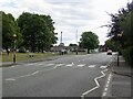
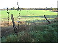
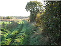
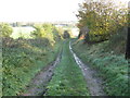
7 photos from this area
Area Information
Key information about the CW9 8SA including its size, population, and administrative classification.
- Area Type
- Postcode
- Area Size
- 9585 m²
- Population
- 1973
- Population Density
- 1768 people/km²
House Prices in CW9 8SA
11
Properties
£233,250
Average Sold Price
£77,000
Lowest Price
£445,000
Highest Price
Showing 11 properties
| Address | Type | Beds | Baths | Last Sale Price | Last Sale Date | |
|---|---|---|---|---|---|---|
| 6 Langley Road, Northwich, CW9 8SA | house | - | - | £445,000 | Nov 2022 | |
| 17 Langley Road, Northwich, CW9 8SA | Detached | 4 | 2 | £300,000 | Nov 2017 | |
| 11 Langley Road, Northwich, CW9 8SA | house | - | - | £280,000 | Dec 2016 | |
| 4 Langley Road, Northwich, CW9 8SA | Detached | 4 | 2 | £205,000 | Oct 2014 | |
| 7 Langley Road, Northwich, CW9 8SA | Detached | - | - | £288,000 | Aug 2007 | |
| 8 Langley Road, Northwich, CW9 8SA | Detached | - | - | £135,000 | Aug 2003 | |
| 19 Langley Road, Northwich, CW9 8SA | Detached | 4 | - | £136,000 | Apr 2000 | |
| 2 Langley Road, Northwich, CW9 8SA | Detached | - | - | £77,000 | Sep 1999 | |
| Aaztec Surveillance Ltd, Warwick House, 1 Langley Road, Northwich, CW9 8SA | Office | - | - | - | - | |
| 9 Langley Road, Northwich, CW9 8SA | Detached | - | - | - | - |
Page 1 of 2
Energy Efficiency in CW9 8SA
Amenities
Schools
| Rank | School | Type | Entry gender | Ages |
|---|
Explore more schools in this area
Go to Schools tabDemographics
Household Size
Two person
most common
Accommodation Type
Houses
most common
Tenure
75
majority
Ethnic Group
White
most common
Religion
N/A
most common
Household Composition
N/A
most common
Age
47
median
Adults (30-64 years)
most common
Household Deprivation
N/A
with no deprivation
NS-SEC
45
in Lower managerial occupations
Explore more demographic insights in this area
Go to Demographics tabPlanning
Planning Constraints
- Flood RiskPremium
- Ramsar Wetland SitesPremium
- Area of Outstanding Natural BeautyPremium
- Protected Nature ReservePremium
- Protected WoodlandPremium