Area Overview for CW7 3GZ
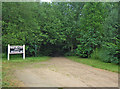
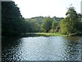
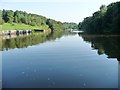
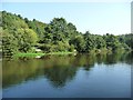
Photos of CW7 3GZ


Area Information
Living in CW7 3GZ means being part of a tightly knit residential cluster in Winsford, a town with medieval roots and a population of around 35,500. This postcode area covers 7,827 square metres, housing 1,708 people in a density of 218,215 per square kilometre. Winsford itself is a historic settlement, with St Chad’s Church dating back over a thousand years and a market charter granted in 1280. The area is defined by its compact size, making it ideal for those seeking proximity to local amenities without the sprawl of larger towns. Daily life here is shaped by the town’s heritage and practical layout, with easy access to rail links and retail hubs. While the population is small, the area’s character is steeped in history, from Saxon cross fragments to 18th-century village landmarks. For buyers, CW7 3GZ offers a blend of tradition and modern convenience, with a focus on homeownership and a community profile skewed towards adults aged 30–64. The high broadband score ensures seamless digital connectivity, while nearby rail stations provide links to broader regional networks.
- Area Type
- Postcode
- Area Size
- 7827 m²
- Population
- 1708
- Population Density
- 2180 people/km²
The property market in CW7 3GZ is characterised by a 59% home ownership rate, with houses being the primary accommodation type. This suggests a market skewed towards owner-occupation rather than rental properties, though the remaining 41% may include renters or leaseholders. The compact size of the area—7,827 square metres—means housing stock is limited, potentially increasing competition among buyers. The prevalence of houses over flats or apartments indicates a preference for single-family homes, which may appeal to those seeking private space and garden access. However, the high population density (218,215 per square kilometre) implies that properties are likely smaller or multi-generational. For buyers, this small area offers a niche market, with limited scope for expansion. Proximity to rail links and retail hubs adds practical value, though the lack of larger housing developments may restrict options. Those considering CW7 3GZ should view it as a specialised market, suited to those prioritising location over property size.
House Prices in CW7 3GZ
No properties found in this postcode.
Energy Efficiency in CW7 3GZ
Daily life in CW7 3GZ is supported by a range of nearby amenities, including five retail outlets such as Morrisons Wharton, Co-op Winsford, and Asda Winsford. These shops provide access to groceries, household goods, and other necessities, reducing the need for long trips to larger centres. The rail network, with stations like Winsford and Greenbank, offers easy access to regional transport, facilitating travel to work, leisure, or social activities. While the data does not mention parks or leisure facilities, the historical character of Winsford—home to landmarks like St Chad’s Church and the 1543 preaching cross—adds cultural value to the area. The compact layout ensures amenities are within practical reach, fostering a convenient lifestyle. For residents, the blend of retail, rail, and heritage sites creates a balanced environment, though those seeking extensive leisure options may need to venture further afield. The area’s practicality and accessibility make it appealing for those prioritising efficiency in daily routines.
Amenities
Schools
The only school explicitly listed near CW7 3GZ is Leaf Lane Infant and Nursery School, a primary institution serving young children. No secondary schools are mentioned in the data, meaning families with older children may need to look beyond the immediate area for secondary education. The presence of a primary school supports families with young children, though the absence of a broader school network could be a consideration for those requiring full-time schooling within the postcode. The single school listed suggests a focus on early education, which aligns with the area’s demographic profile of adults aged 30–64. For buyers prioritising schools, the availability of a primary institution is a positive, but the need for additional schooling options should be factored into long-term plans. The lack of secondary schools may influence decisions about proximity to larger towns with more comprehensive education facilities.
| Rank | School | Type | Entry gender | Ages |
|---|
Explore more schools in this area
Go to Schools tabDemographics
The population of CW7 3GZ is 1,708, with a median age of 47, indicating a mature community. The most common age group is adults aged 30–64, reflecting a stable demographic profile. Home ownership stands at 59%, with houses being the predominant accommodation type. The area is ethnically homogenous, with the White population forming the majority. This suggests a community with established roots and limited demographic diversity. The high population density—218,215 per square kilometre—means living spaces are compact, which may influence lifestyle choices. While no specific deprivation data is provided, the age profile and ownership rates imply a population prioritising long-term stability over transient living. The absence of significant age groups under 25 or over 65 suggests a community focused on middle-aged individuals, likely with families or those in later career stages. This demographic may influence local services and amenities, with a focus on practicality over youth-centric or retirement-oriented facilities.
Household Size
Accommodation Type
Tenure
Ethnic Group
Religion
Household Composition
Age
Household Deprivation
NS-SEC
Explore more demographic insights in this area
Go to Demographics tabPlanning
Planning Constraints
- Flood RiskPremium
- Ramsar Wetland SitesPremium
- Area of Outstanding Natural BeautyPremium
- Protected Nature ReservePremium
- Protected WoodlandPremium