Area Overview for CW7 3BU
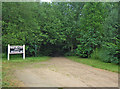
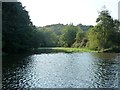
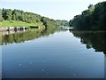
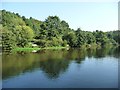
Photos of CW7 3BU


Area Information
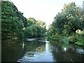
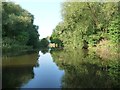
Living in CW7 3BU means being part of a tightly knit, small-scale residential cluster in the town of Winsford, Cheshire. The area covers 22.9 hectares and is home to 1,708 people, resulting in a high population density of 7,448 people per square kilometre. This density reflects a compact, possibly older settlement pattern, typical of historic townships like Winsford, which has roots in medieval times. The area is part of a larger town with a population of around 35,500, but CW7 3BU itself is a microcosm of its surroundings. Residents here are likely to find a mix of traditional and modern living, with proximity to the River Weaver and historical landmarks such as St Chad’s Church. Daily life is shaped by the town’s heritage, with local markets and community events continuing traditions dating back to the 13th century. The area’s small size means a strong sense of local identity, though its density may influence the pace of life. For those seeking a quiet, historic town with a tight-knit community, CW7 3BU offers a glimpse into Cheshire’s past while remaining connected to contemporary amenities.
- Area Type
- Postcode
- Area Size
- 22.9 hectares
- Population
- 1708
- Population Density
- 2180 people/km²
The property market in CW7 3BU is characterised by a high rate of home ownership (59%) and a predominance of houses as the primary accommodation type. This suggests a market skewed towards owner-occupied properties rather than rental units, which may appeal to those seeking long-term stability. The small area size—22.9 hectares—means the housing stock is likely limited, with properties concentrated in a compact space. Given the high population density, the area may have a mix of older, traditional homes and newer developments, though specific data on property types or prices is not provided. For buyers, the focus on houses implies a market where family homes or larger properties are more common, potentially making it less suitable for those seeking smaller or more modern units. The limited scale of the area also means that the immediate surroundings may offer similar housing options, reducing the variety available to prospective buyers.
House Prices in CW7 3BU
Showing 2 properties
| Address | Type | Beds | Baths | Last Sale Price | Last Sale Date | |
|---|---|---|---|---|---|---|
| Colin Stewart Minchem, Amcol Minerals Europe, Weaver Valley Road, Winsford, CW7 3BU | Industrial | - | - | - | - | |
| Amcol Minerals Europe Ltd, Wharton Lodge Mills, Amcol Minerals Europe, Weaver Valley Road, Winsford, CW7 3BU | Industrial | - | - | - | - |
Energy Efficiency in CW7 3BU
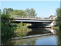
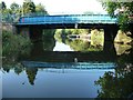
Residents of CW7 3BU have access to a range of nearby amenities within practical reach. The area includes five retail outlets, such as Morrisons Wharton, Co-op Winsford, and Asda Winsford, providing essential shopping options for daily needs. These stores likely offer a mix of groceries, household items, and other services, supporting a convenient lifestyle. The presence of multiple railway stations—Winsford, Hartford, and Greenbank—enhances connectivity, allowing residents to travel easily to nearby towns or cities. While the data does not specify parks or leisure facilities, the historical context of Winsford suggests potential for green spaces or heritage sites. The combination of retail access and rail links indicates a practical, community-focused lifestyle, though further details on recreational amenities would be needed to fully assess the area’s appeal for leisure activities.
Amenities
Schools
The nearest school to CW7 3BU is Leaf Lane Infant and Nursery School, a primary school serving young children. While no Ofsted rating is provided, the presence of a primary school suggests the area is well-served for early education. However, the absence of secondary schools or other educational institutions in the data means families may need to look beyond the immediate vicinity for comprehensive schooling. The single primary school listed indicates a focus on younger age groups, which could be sufficient for families with children under 11 but may require additional planning for older students. The school’s location within practical reach of residents highlights its accessibility, though the lack of further details on its performance or facilities means potential buyers should investigate independently to assess its suitability for their needs.
| Rank | School | Type | Entry gender | Ages |
|---|
Explore more schools in this area
Go to Schools tabDemographics
The population of CW7 3BU has a median age of 47, with the most common age range being adults between 30 and 64 years. This suggests a community skewed towards middle-aged individuals, possibly reflecting a stable, long-term resident base. Home ownership is strong, with 59% of households owning their homes, and the predominant accommodation type is houses, indicating a residential area with larger properties rather than flats or apartments. The predominant ethnic group is White, which aligns with broader trends in the region. The high proportion of homeowners and the age profile suggest a population that values stability and long-term investment in property. However, the absence of specific data on deprivation or diversity means the area’s social dynamics remain partially unexplored. For buyers, this demographic profile implies a market where properties are likely to be held by established residents rather than transient renters.
Household Size
Accommodation Type
Tenure
Ethnic Group
Religion
Household Composition
Age
Household Deprivation
NS-SEC
Explore more demographic insights in this area
Go to Demographics tabPlanning
Planning Constraints
- Flood RiskPremium
- Ramsar Wetland SitesPremium
- Area of Outstanding Natural BeautyPremium
- Protected Nature ReservePremium
- Protected WoodlandPremium