Area Overview for CW7 2TY
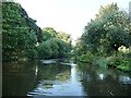
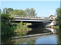
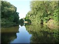
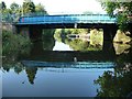
Photos of CW7 2TY


Area Information
Living in CW7 2TY means being part of a compact, residential cluster in the heart of Winsford, Cheshire. This area, spanning 1.6 hectares, is home to 1,333 residents, with a population density of 358 people per square kilometre. Winsford itself is a historic town with roots in medieval times, where St Chad’s Church and the River Weaver define its character. The area’s small size fosters a close-knit community, with daily life shaped by its proximity to local amenities and historical landmarks. Residents benefit from nearby railway stations, including Winsford and Hartford, which connect to broader networks. While the area’s compact nature means it is not sprawling, it offers a blend of residential tranquillity and access to the town’s market, which dates back to a 1280 charter. The demographic profile—primarily middle-aged homeowners—suggests a stable, long-term community. For those seeking a balance between historical charm and modern convenience, CW7 2TY provides a distinct slice of Cheshire life.
- Area Type
- Postcode
- Area Size
- 1.6 hectares
- Population
- 1333
- Population Density
- 358 people/km²
The property market in CW7 2TY is heavily weighted towards owner-occupation, with 82% of homes owned by residents rather than rented. This suggests a stable, long-term demographic with limited turnover. The accommodation type is predominantly houses, which is unusual for a small postcode area but aligns with Winsford’s traditional housing stock. Given the area’s size—just 1.6 hectares—and its small population, the housing stock is likely to be limited, with few new developments. Buyers should consider nearby areas for more options, as the immediate vicinity may have constrained availability. The high home ownership rate also indicates that properties here may be held for the long term, potentially offering security for buyers seeking a settled location.
House Prices in CW7 2TY
Showing 35 properties
| Address | Type | Beds | Baths | Last Sale Price | Last Sale Date | |
|---|---|---|---|---|---|---|
| 24 Dutch Close, Winsford, CW7 2TY | Flat | - | - | - | - | |
| 19 Dutch Close, Winsford, CW7 2TY | house | - | - | - | - | |
| 21 Dutch Close, Winsford, CW7 2TY | house | - | - | - | - | |
| 37 Dutch Close, Winsford, CW7 2TY | Flat | - | - | - | - | |
| 26 Dutch Close, Winsford, CW7 2TY | Flat | - | - | - | - | |
| 43 Dutch Close, Winsford, CW7 2TY | Flat | - | - | - | - | |
| 33 Dutch Close, Winsford, CW7 2TY | Flat | - | - | - | - | |
| 31 Dutch Close, Winsford, CW7 2TY | Flat | - | - | - | - | |
| 36 Dutch Close, Winsford, CW7 2TY | Flat | - | - | - | - | |
| 39 Dutch Close, Winsford, CW7 2TY | Flat | - | - | - | - |
Energy Efficiency in CW7 2TY
Residents of CW7 2TY have access to a range of nearby amenities, including five retail outlets such as Morrisons Wharton, Asda Winsford, and Co-op Winsford, ensuring daily shopping needs are met. The area’s proximity to Winsford’s historic market, which dates to the 13th century, adds a unique character to local life. Rail connectivity is strong, with five stations—Winsford, Hartford, and Greenbank—offering links to broader transport networks. While the area is small, its integration with Winsford’s broader infrastructure means residents can enjoy a mix of historical sites, such as St Chad’s Church, and modern conveniences. The presence of multiple retail options and transport hubs supports a practical, community-focused lifestyle, where local traditions and modern amenities coexist.
Amenities
Schools
| Rank | School | Type | Entry gender | Ages |
|---|
Explore more schools in this area
Go to Schools tabDemographics
The community in CW7 2TY is predominantly composed of adults aged 30–64, with a median age of 47. This suggests a mature, established population, many of whom are likely to be long-term residents. Home ownership is high, with 82% of properties occupied by owners, reflecting a stable housing market. The area is characterised by houses rather than flats or apartments, indicating a focus on family-friendly or semi-detached living. The predominant ethnic group is White, aligning with broader trends in the region. With 1,333 residents, the population density of 358 people per square kilometre means the area is neither overcrowded nor sparse. This demographic profile implies a community with a strong sense of continuity, where local institutions and services are likely to cater to long-standing residents.
Household Size
Accommodation Type
Tenure
Ethnic Group
Religion
Household Composition
Age
Household Deprivation
NS-SEC
Explore more demographic insights in this area
Go to Demographics tabPlanning
Planning Constraints
- Flood RiskPremium
- Ramsar Wetland SitesPremium
- Area of Outstanding Natural BeautyPremium
- Protected Nature ReservePremium
- Protected WoodlandPremium