Area Overview for CW7 3GP
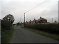
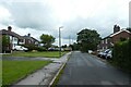
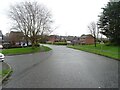
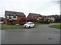
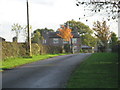
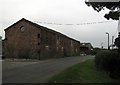
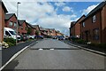
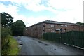
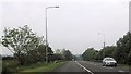
Photos of CW7 3GP
Area Information
Living in CW7 3GP means being part of a tightly knit residential cluster within the town of Winsford, Cheshire. The area covers 1,543 square metres and is home to 1,218 people, translating to a high population density of 1,171 people per square kilometre. This compact postcode area sits within a historic town that once merged the townships of Over and Wharton in 1936. Daily life here is shaped by its proximity to Winsford’s market heritage, with the town’s 13th-century origins still evident in its landmarks like St Chad’s Church. The area’s small size means residents are close to amenities, from retail outlets to railway stations, while the surrounding landscape offers a mix of urban convenience and rural character. With a median age of 47 and a population skewed toward adults aged 30–64, CW7 3GP reflects a community rooted in stability, with 77% of homes owner-occupied. This suggests a mature, established demographic that values long-term residency over transient living.
- Area Type
- Postcode
- Area Size
- 1543 m²
- Population
- 1218
- Population Density
- 1171 people/km²
The property market in CW7 3GP is characterised by high home ownership (77%) and a predominance of houses rather than flats or apartments. This suggests a mature, settled community with limited rental activity, as the area is not a hotspot for transient buyers or investors. The small size of the postcode area—just 1,543 square metres—means the housing stock is likely limited, with properties concentrated in a tight cluster. For buyers, this implies a stable market with fewer new developments but potential for long-term value retention. The focus on houses over other property types may appeal to families seeking space and privacy, though the compact nature of the area could mean competition for available homes. Prospective buyers should consider the proximity to nearby towns like Winsford, where additional options might exist for those seeking more space or alternative layouts.
House Prices in CW7 3GP
Showing 6 properties
| Address | Type | Beds | Baths | Last Sale Price | Last Sale Date | |
|---|---|---|---|---|---|---|
| 4 Trinity Fields, Winsford, CW7 3GP | Detached | 4 | 3 | £295,000 | Aug 2023 | |
| 2 Trinity Fields, Winsford, CW7 3GP | Detached | 4 | 1 | £215,000 | Dec 2019 | |
| 6 Trinity Fields, Winsford, CW7 3GP | Detached | 4 | 3 | £228,000 | Sep 2018 | |
| 3 Trinity Fields, Winsford, CW7 3GP | Detached | 4 | 3 | £216,500 | Jul 2018 | |
| 5 Trinity Fields, Winsford, CW7 3GP | house | - | - | £227,000 | Sep 2017 | |
| 1 Trinity Fields, Winsford, CW7 3GP | house | - | - | £230,000 | May 2017 |
Energy Efficiency in CW7 3GP
The lifestyle in CW7 3GP is shaped by its proximity to essential amenities within walking or short driving distance. Retail options include major supermarkets like Morrisons Wharton, Co-op Winsford, and Asda Winsford, providing convenience for grocery shopping and daily essentials. The area’s railway stations—Winsford, Hartford, and Greenbank—offer access to regional transport, linking residents to nearby towns and cities. While the data does not mention parks or leisure facilities, the town’s historic market and landmarks like St Chad’s Church suggest a blend of urban and heritage elements. The compact nature of the area means residents are close to services, though those seeking more extensive recreational options may need to travel to nearby towns. The combination of retail, transport, and historical context creates a practical, community-focused lifestyle.
Amenities
Schools
The primary school closest to CW7 3GP is Wharton Church of England Junior School, which serves the local community. While no Ofsted rating is provided, the presence of a dedicated primary school indicates that families in the area have access to foundational education. However, the data does not mention secondary schools or other educational institutions in the immediate vicinity, meaning parents may need to look beyond the postcode area for comprehensive schooling. The single primary school suggests that the community is small enough to support a local institution but may require additional planning for older children. For families prioritising proximity to schools, the availability of a primary option is a clear benefit, though secondary education options remain unspecified in the data.
| Rank | School | Type | Entry gender | Ages |
|---|
Explore more schools in this area
Go to Schools tabDemographics
The community in CW7 3GP is predominantly composed of adults aged 30–64, with a median age of 47. This age range indicates a population largely in their prime working years, likely supporting a mix of family households and single-person homes. Home ownership is high, with 77% of properties owner-occupied, suggesting a stable, long-term resident base. The area’s accommodation is primarily houses, which aligns with the demographic profile of older, established households. The predominant ethnic group is White, reflecting the broader demographic trends in Cheshire. The high population density—1,171 people per square kilometre—means the area is compact, with limited open space but a strong sense of local identity. This density, combined with the high home ownership rate, implies a community that values familiarity and proximity to services over expansion or development.
Household Size
Accommodation Type
Tenure
Ethnic Group
Religion
Household Composition
Age
Household Deprivation
NS-SEC
Explore more demographic insights in this area
Go to Demographics tabPlanning
Planning Constraints
- Flood RiskPremium
- Ramsar Wetland SitesPremium
- Area of Outstanding Natural BeautyPremium
- Protected Nature ReservePremium
- Protected WoodlandPremium