Area Overview for CW7 3ED
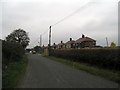
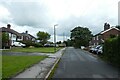
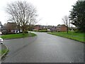
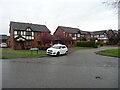
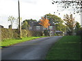
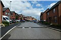
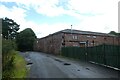
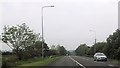
Photos of CW7 3ED

Area Information
CW7 3ED is a small residential postcode in Winsford, a town in Cheshire’s Winsford Gravel ward. Situated around Merlin Close, the area is part of Winsford’s built-up urban fabric, with coordinates placing it near 53.189615°N, -2.505722°E. The postcode covers a compact cluster of homes, with nearby streets like Station Road and Wharton Road showing active property sales. Winsford itself is a town with a mix of local amenities, including the Winsford Industrial Estate, which hosts businesses such as Britton Taco Ltd. The area is within the Crewe travel to work area, linking residents to broader economic opportunities. Daily life here is shaped by proximity to Winsford’s core, with local bus routes and a nearby railway station offering transport options. The area’s average household income of £39,500 (2020 data) and a relatively low deprivation rank of 18,635/32,844 (2019) suggest a community that balances affordability with access to services. Living in CW7 3ED means being part of a small, functional town with straightforward connectivity, though the postcode’s size means it is best suited for those seeking a compact, localised environment rather than sprawling suburbs.
- Area Type
- Postcode
- Area Size
- 8003 m²
- Population
- 1218
- Population Density
- 1171 people/km²
The property market in CW7 3ED is defined by modest prices and a focus on owner-occupation. Recent data shows an average price of £2,120 per square metre in the CW7 3 sector, with active sales on nearby streets like Station Road and Wharton Road. This suggests a market where homes are primarily bought for long-term residence rather than investment. The area’s compact size means property choices are limited to individual streets, with no indication of large-scale development or rental-focused housing. The Winsford Industrial Estate nearby may provide employment opportunities, reducing reliance on commuting, though property values here remain lower than in Crewe, where the average is £250,039. Buyers in CW7 3ED should expect a straightforward, low-maintenance market with no planning restrictions or environmental constraints. However, the small postcode size means availability is limited, and those seeking a wider selection may need to look beyond immediate surroundings.
House Prices in CW7 3ED
Showing 16 properties
| Address | Type | Beds | Baths | Last Sale Price | Last Sale Date | |
|---|---|---|---|---|---|---|
| 2 Merlin Close, Winsford, CW7 3ED | Detached | 3 | 1 | £220,000 | Apr 2023 | |
| 6 Merlin Close, Winsford, CW7 3ED | Detached | 3 | 3 | £235,000 | Aug 2022 | |
| 15 Merlin Close, Winsford, CW7 3ED | Detached | 3 | - | £210,000 | Oct 2021 | |
| 9 Merlin Close, Winsford, CW7 3ED | house | - | - | £231,500 | Jun 2020 | |
| 17 Merlin Close, Winsford, CW7 3ED | Detached | 3 | 2 | £184,000 | Jan 2020 | |
| 8 Merlin Close, Winsford, CW7 3ED | Detached | 4 | 3 | £192,000 | Nov 2015 | |
| 7 Merlin Close, Winsford, CW7 3ED | house | - | - | £171,500 | Sep 2013 | |
| 16 Merlin Close, Winsford, CW7 3ED | Detached | - | - | £178,000 | May 2007 | |
| 1 Merlin Close, Winsford, CW7 3ED | Detached | 3 | - | £99,950 | Apr 2002 | |
| 5 Merlin Close, Winsford, CW7 3ED | Detached | - | - | - | - |
Energy Efficiency in CW7 3ED
Amenities
Schools
| Rank | School | Type | Entry gender | Ages |
|---|
Explore more schools in this area
Go to Schools tabDemographics
The community in CW7 3ED reflects Winsford’s broader demographic profile. The area’s Index of Multiple Deprivation rank of 18,635/32,844 (2019) places it in the less deprived half of England, indicating better access to services, lower poverty rates, and higher income levels compared to the national average. Average household income here is £39,500 (2020 data), which is in line with nearby areas but slightly below the Cheshire average. The area is classified as urban, suggesting a mix of family homes and smaller properties. While specific data on age profiles or household types is not provided, the low deprivation score implies a stable, working-age population with fewer socioeconomic challenges. This stability may translate to a community with established local networks, though the small postcode size means the population is likely modest. The absence of protected natural areas or planning constraints suggests a straightforward housing market, with no restrictions limiting development or land use.
Household Size
Accommodation Type
Tenure
Ethnic Group
Religion
Household Composition
Age
Household Deprivation
NS-SEC
Explore more demographic insights in this area
Go to Demographics tabPlanning
Planning Constraints
- Flood RiskPremium
- Ramsar Wetland SitesPremium
- Area of Outstanding Natural BeautyPremium
- Protected Nature ReservePremium
- Protected WoodlandPremium