Area Overview for CW7 3DH
Photos of CW7 3DH


Area Information
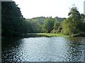
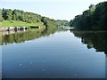
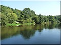
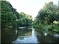
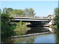
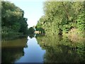
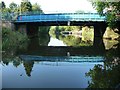
CW7 3DH is a small, tightly packed residential cluster in Cheshire, England, situated near the River Weaver and within reach of Northwich and Middlewich. With a population of 1,708 spread across 4,925 square metres, the area is densely populated, reflecting a compact, community-focused layout. The postcode falls within Winsford, a town with medieval roots and a historic market charter dating to 1280. Daily life here is shaped by its proximity to local amenities, including retail outlets and rail links, while the surrounding landscape offers a blend of historical sites and natural features. The area’s high population density means it is a well-established residential hub, with homes predominantly in private ownership. Residents benefit from proximity to nearby towns, though the small size of CW7 3DH means the immediate surroundings are key for broader access to services. Its location on the River Weaver and connections to Cheshire’s transport networks make it a practical choice for those seeking a mix of historical charm and modern convenience.
- Area Type
- Postcode
- Area Size
- 4925 m²
- Population
- 1708
- Population Density
- 2180 people/km²
The property market in CW7 3DH is dominated by owner-occupied homes, with 59% of properties in private hands. The accommodation type is primarily houses, which is typical for a small, established residential area. This suggests a focus on family homes rather than flats or apartments, which are less common here. Given the high population density and limited area size, the housing stock is likely constrained, making the local market competitive for buyers. The immediate surroundings may offer more options, but the small postcode area itself is unlikely to have significant new developments. For buyers, this means a focus on existing properties, with potential for long-term value retention in a stable, low-flood-risk environment. However, the high crime risk in the area could affect desirability for some.
House Prices in CW7 3DH
Showing 16 properties
| Address | Type | Beds | Baths | Last Sale Price | Last Sale Date | |
|---|---|---|---|---|---|---|
| 10 Barton Court, Winsford, CW7 3DH | Flat | 1 | - | - | - | |
| 16 Barton Court, Winsford, CW7 3DH | Flat | - | - | - | - | |
| 4 Barton Court, Winsford, CW7 3DH | Flat | - | - | - | - | |
| 6 Barton Court, Winsford, CW7 3DH | Maisonette | - | - | - | - | |
| 8 Barton Court, Winsford, CW7 3DH | Maisonette | - | - | - | - | |
| 1 Barton Court, Winsford, CW7 3DH | Maisonette | - | - | - | - | |
| 9 Barton Court, Winsford, CW7 3DH | Flat | - | - | - | - | |
| 17 Barton Court, Winsford, CW7 3DH | Flat | - | - | - | - | |
| 7 Barton Court, Winsford, CW7 3DH | Maisonette | - | - | - | - | |
| 12 Barton Court, Winsford, CW7 3DH | Flat | - | - | - | - |
Energy Efficiency in CW7 3DH
The lifestyle in CW7 3DH is shaped by its proximity to retail and transport hubs. Nearby amenities include Morrisons Wharton, Co-op Winsford, and Asda Winsford, offering essential shopping and dining options. The rail stations—Winsford, Hartford, and Greenbank—provide easy access to regional travel, enhancing convenience for commuters. While the data does not list parks or leisure facilities, the area’s historical sites, such as St Chad’s Church and the River Weaver, suggest opportunities for cultural and recreational activities. The compact nature of the postcode means daily life revolves around local services, with the surrounding towns of Northwich and Middlewich providing additional options. The blend of practical amenities and historical context creates a functional, community-oriented environment.
Amenities
Schools
The nearest school to CW7 3DH is Leaf Lane Infant and Nursery School, a primary institution serving local children. No secondary schools are listed in the data, so families may need to look further afield for secondary education. The presence of a primary school suggests the area is suitable for young families, though the absence of nearby secondary schools could be a consideration for those requiring a full range of educational options. The school’s type and performance are not detailed here, but its existence indicates a basic infrastructure for education. Parents may need to factor in commuting times to secondary schools in nearby towns like Winsford or Middlewich.
| Rank | School | Type | Entry gender | Ages |
|---|
Explore more schools in this area
Go to Schools tabDemographics
The community in CW7 3DH is predominantly composed of adults aged 30–64, with a median age of 47. This suggests a mature, settled population, likely with long-term ties to the area. Home ownership rates are 59%, indicating a mix of private and rental properties, though the data does not specify the latter. The accommodation type is primarily houses, which aligns with the area’s compact, residential character. The predominant ethnic group is White, though no further breakdown of diversity is provided. The population density of 346,810 people per square kilometre is exceptionally high for such a small area, implying a tightly knit community. This density may influence local dynamics, such as shared resources and social interactions. The age profile suggests a stable demographic, with fewer young families or elderly residents compared to other areas.
Household Size
Accommodation Type
Tenure
Ethnic Group
Religion
Household Composition
Age
Household Deprivation
NS-SEC
Explore more demographic insights in this area
Go to Demographics tabPlanning
Planning Constraints
- Flood RiskPremium
- Ramsar Wetland SitesPremium
- Area of Outstanding Natural BeautyPremium
- Protected Nature ReservePremium
- Protected WoodlandPremium