Area Overview for CW7 2QQ
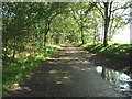
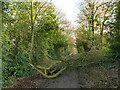
Photos of CW7 2QQ


Area Information
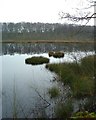
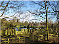
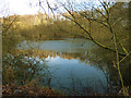
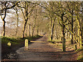
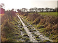
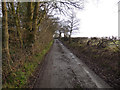
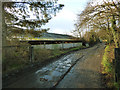
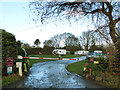
CW7 2QQ is a small, tightly knit residential postcode area in Cheshire, England, covering 74.9 hectares and home to 1,953 people. Its low population density of 110 people per square kilometre suggests a quiet, rural character, with housing concentrated around the villages of Whitegate and Marton. The area retains historical significance, including St Mary’s Church, built in 1726, and proximity to Vale Royal Abbey, once Britain’s largest Cistercian abbey. Residents here are predominantly adults aged 30–64, with a median age of 47, reflecting a mature, stable community. Daily life is shaped by the surrounding countryside, with nearby hamlets like Foxwist Green and Nova Scotia offering a traditional, low-key rural lifestyle. The area’s proximity to the River Weaver and historic footpaths, such as the Whitegate Way, adds to its charm. While small, CW7 2QQ is connected to nearby towns like Winsford and Northwich via rail, with stations at Cuddington, Hartford, and Delamere. This blend of historical heritage, natural beauty, and practical connectivity makes it a distinctive choice for those seeking a peaceful yet accessible location.
- Area Type
- Postcode
- Area Size
- 74.9 hectares
- Population
- 1953
- Population Density
- 110 people/km²
The property market in CW7 2QQ is dominated by owner-occupied homes, with 90% of properties owned by residents rather than rented. This high home ownership rate suggests a long-term, stable community with limited turnover, which can be attractive to buyers seeking a secure investment. The area’s housing stock is primarily composed of houses, reflecting a traditional, suburban or semi-rural layout. Given the small size of the postcode area and its focus on residential clusters, property availability is likely limited, making it a niche market for those prioritising low-density living. The proximity to nearby towns like Winsford and Northwich, combined with rail links to Hartford and Delamere stations, may appeal to buyers seeking a balance between rural tranquillity and urban accessibility. However, the small scale of the area means that property searches here should consider adjacent postcode areas for broader options. The high home ownership and house-centric stock indicate a market that values privacy, space, and a connection to the surrounding landscape.
House Prices in CW7 2QQ
Showing 7 properties
| Address | Type | Beds | Baths | Last Sale Price | Last Sale Date | |
|---|---|---|---|---|---|---|
| Coach Road Farm, Clay Lane, Marton, Winsford, CW7 2QQ | Detached | 3 | 1 | - | - | |
| Hardy Barn, Clay Lane, Marton, Winsford, CW7 2QQ | Detached | - | - | - | - | |
| Dairy Cottage, Clay Lane, Marton, Winsford, CW7 2QQ | Detached | - | - | - | - | |
| Totties Hall, Clay Lane, Marton, Winsford, CW7 2QQ | Detached | - | - | - | - | |
| Totties Hall Farm, Clay Lane, Marton, Winsford, CW7 2QQ | Detached | - | - | - | - | |
| Daisy Bank Farm, Clay Lane, Marton, Winsford, CW7 2QQ | Detached | - | - | - | - | |
| Coach Road Villa, Clay Lane, Marton, Winsford, CW7 2QQ | Detached | - | - | - | - |
Energy Efficiency in CW7 2QQ
Living in CW7 2QQ offers access to a range of local amenities within practical reach, including five retail outlets such as Spar, Budgens Tarporley, and Morrisons Daily. These shops provide essential services for daily living, from groceries to convenience items. The area’s proximity to railway stations—Cuddington, Hartford, and Delamere—enhances its connectivity, allowing residents to travel to nearby towns for additional shopping, dining, or leisure opportunities. While the data does not specify parks or recreational facilities, the historical footpaths like the Whitegate Way suggest opportunities for walking or cycling. The surrounding countryside, including the River Weaver and nearby hamlets, likely supports a lifestyle centred on outdoor activities and a slower pace of life. The presence of St Mary’s Church and Vale Royal Abbey adds cultural and historical depth to the area. Overall, CW7 2QQ combines rural tranquillity with sufficient local amenities, making it appealing to those who value convenience without sacrificing a peaceful environment.
Amenities
Schools
The nearest school to CW7 2QQ is Whitegate CofE Primary School, which serves the local community with a good Ofsted rating. This primary school is the only educational institution explicitly listed in the data, meaning families in the area rely on it for early education. The absence of secondary schools nearby suggests that students may need to travel to nearby towns like Winsford or Northwich for further education. The presence of a well-rated primary school is a significant draw for families, as it indicates a commitment to quality education within the community. However, the lack of additional schools, particularly secondary institutions, could be a consideration for those planning for long-term family needs. The school’s location within practical reach of residents highlights its role as a central amenity in the area, supporting the local demographic of families with young children.
| Rank | School | Type | Entry gender | Ages |
|---|
Explore more schools in this area
Go to Schools tabDemographics
The community in CW7 2QQ is predominantly composed of adults aged 30–64, with a median age of 47, indicating a mature population. Home ownership is exceptionally high at 90%, suggesting long-term residency and stability. The area is primarily occupied by houses, reflecting a traditional, family-oriented housing stock. The predominant ethnic group is White, with no specific data on other demographics provided. The low population density of 110 people per square kilometre reinforces the area’s rural, low-traffic character. While no deprivation data is explicitly mentioned, the high home ownership and age profile imply a relatively affluent, settled community. This demographic profile suggests a lifestyle prioritising comfort, privacy, and connection to the surrounding countryside. The absence of significant diversity data means the area’s social dynamics are likely homogenous, though this does not necessarily indicate a lack of inclusivity. The age group’s focus on middle-aged and older adults may influence local services and amenities, aligning with the needs of a mature population.
Household Size
Accommodation Type
Tenure
Ethnic Group
Religion
Household Composition
Age
Household Deprivation
NS-SEC
Explore more demographic insights in this area
Go to Demographics tabPlanning
Planning Constraints
- Flood RiskPremium
- Ramsar Wetland SitesPremium
- Area of Outstanding Natural BeautyPremium
- Protected Nature ReservePremium
- Protected WoodlandPremium