Area Overview for CW7 2QE
Photos of CW7 2QE
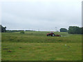
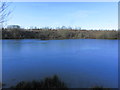
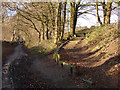

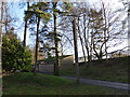
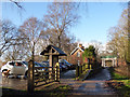
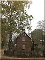
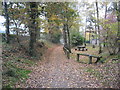
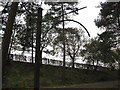
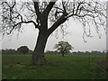
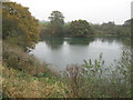
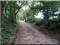
14 photos from this area
Area Information
Key information about the CW7 2QE including its size, population, and administrative classification.
- Area Type
- Postcode
- Area Size
- 11.8 hectares
- Population
- 1953
- Population Density
- 110 people/km²
House Prices in CW7 2QE
18
Properties
£269,846
Average Sold Price
£92,000
Lowest Price
£420,000
Highest Price
Showing 18 properties
| Address | Type | Beds | Baths | Last Sale Price | Last Sale Date | |
|---|---|---|---|---|---|---|
| Little Wood Cottage, Clay Lane, Marton, Winsford, CW7 2QE | Semi-detached | 3 | 1 | £378,500 | Mar 2025 | |
| Amulree, Clay Lane, Marton, Winsford, CW7 2QE | Semi-detached | 4 | 1 | £420,000 | Apr 2024 | |
| Wynsgate, Clay Lane, Marton, Winsford, CW7 2QE | house | - | - | £215,000 | Apr 2020 | |
| Oakfield, Clay Lane, Marton, Winsford, CW7 2QE | Detached | 3 | - | £340,000 | Aug 2019 | |
| Foxwood, Clay Lane, Marton, Winsford, CW7 2QE | Semi-detached | 4 | 1 | £305,000 | Aug 2018 | |
| Glengarth, Clay Lane, Marton, Winsford, CW7 2QE | Bungalow | - | - | £250,000 | Aug 2017 | |
| Calderstone, Clay Lane, Marton, Winsford, CW7 2QE | Detached | - | - | £240,000 | Oct 2015 | |
| Langdale, Clay Lane, Marton, Winsford, CW7 2QE | Semi-detached | 4 | - | £310,000 | Sep 2014 | |
| Oaklands, Clay Lane, Marton, Winsford, CW7 2QE | Detached | - | - | £375,000 | Mar 2007 | |
| Wyndham, Clay Lane, Marton, Winsford, CW7 2QE | Semi-detached | - | - | £242,500 | Jul 2005 |
Page 1 of 2
Energy Efficiency in CW7 2QE
Amenities
Schools
| Rank | School | Type | Entry gender | Ages |
|---|
Explore more schools in this area
Go to Schools tabDemographics
Household Size
Two person
most common
Accommodation Type
Houses
most common
Tenure
90
majority
Ethnic Group
White
most common
Religion
N/A
most common
Household Composition
N/A
most common
Age
47
median
Adults (30-64 years)
most common
Household Deprivation
N/A
with no deprivation
NS-SEC
54
in Lower managerial occupations
Explore more demographic insights in this area
Go to Demographics tabPlanning
Planning Constraints
- Flood RiskPremium
- Ramsar Wetland SitesPremium
- Area of Outstanding Natural BeautyPremium
- Protected Nature ReservePremium
- Protected WoodlandPremium