Area Overview for CW7 1PA
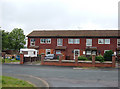
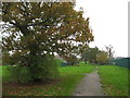
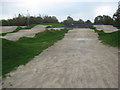
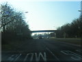
Photos of CW7 1PA


Area Information
Living in CW7 1PA means being part of a tightly knit residential cluster in the town of Winsford, Cheshire. This postcode area covers just 2.4 hectares, housing 1,750 people in a densely populated setting. Winsford itself has a population of around 35,500, with a history stretching back to medieval times, including St Chad’s Church, one of the oldest places of worship in the region. The area is defined by its small-scale charm, with local landmarks like the 1543 preaching cross and historic village lockups. Daily life here is shaped by proximity to retail, rail, and schools, while the town’s market, dating to a 1280 charter, continues to thrive. Residents benefit from easy access to nearby railway stations and a range of primary schools, making it a practical choice for families. The compact size of CW7 1PA means a strong sense of community, though the high population density may feel limiting for those seeking expansive living spaces.
- Area Type
- Postcode
- Area Size
- 2.4 hectares
- Population
- 1750
- Population Density
- 4351 people/km²
The property market in CW7 1PA is characterised by a high rate of home ownership (63%) and a dominance of houses over flats or other accommodation types. This suggests a community where long-term residency is common, with many properties likely being family homes. The small area size and high population density imply limited scope for new developments, making existing housing stock the primary focus for buyers. Given the compact nature of the postcode, property values may be influenced by proximity to local amenities such as schools, rail links, and retail. However, the lack of specific data on property prices or market trends means buyers should consider the area’s limited expansion potential. The predominance of houses may appeal to those seeking traditional family homes, though the tight space could pose challenges for larger households.
House Prices in CW7 1PA
Showing 50 properties
| Address | Type | Beds | Baths | Last Sale Price | Last Sale Date | |
|---|---|---|---|---|---|---|
| 3 Pennine Way, Winsford, CW7 1PA | Terraced | - | - | - | - | |
| 1 Pennine Way, Winsford, CW7 1PA | Semi-detached | - | - | - | - | |
| 15 Pentland Close, Winsford, CW7 1PA | Bungalow | - | - | - | - | |
| 21 Pentland Close, Winsford, CW7 1PA | Bungalow | - | - | - | - | |
| 23 Pentland Close, Winsford, CW7 1PA | house | - | - | - | - | |
| 24 Pentland Close, Winsford, CW7 1PA | house | - | - | - | - | |
| 25 Pentland Close, Winsford, CW7 1PA | house | - | - | - | - | |
| 11 Pentland Close, Winsford, CW7 1PA | Bungalow | - | - | - | - | |
| 7 Pentland Close, Winsford, CW7 1PA | house | - | - | - | - | |
| 10 Pentland Close, Winsford, CW7 1PA | Bungalow | - | - | - | - |
Energy Efficiency in CW7 1PA
The lifestyle in CW7 1PA is shaped by its proximity to retail, dining, and transport hubs. Nearby amenities include Morrisons Daily, Spar, and Tesco Winsford, offering everyday shopping needs within walking distance. The area’s rail links to Winsford, Hartford, and Cuddington provide easy access to broader regional networks, enhancing mobility for work, leisure, or travel. While the data does not specify parks or leisure facilities, the town’s historical landmarks and market suggest a blend of practicality and local character. The compact nature of the postcode means amenities are tightly clustered, fostering a convenience-driven lifestyle. Residents benefit from a balance of small-town charm and modern infrastructure, though the lack of detailed information on green spaces or recreational facilities leaves some aspects of daily life unexplored.
Amenities
Schools
Residents of CW7 1PA have access to several primary schools, including Greenfields Primary School, Over St John’s CofE Primary School (rated ‘good’ by Ofsted), St Joseph’s Catholic Primary School, and The Oak View Academy (also rated ‘good’). The presence of both state and faith-based schools offers families a range of educational options. The inclusion of an academy, The Oak View Academy, suggests a mix of traditional and alternative educational approaches. For parents, the availability of two ‘good’-rated schools within the area is a significant advantage, though the absence of secondary schools means students may need to travel to nearby towns. The concentration of primary schools indicates a family-friendly environment, with education being a key consideration for homebuyers in the area.
| Rank | School | Type | Entry gender | Ages |
|---|
Explore more schools in this area
Go to Schools tabDemographics
The population of CW7 1PA has a median age of 47, with the majority of residents aged between 30 and 64. This suggests a community skewed toward adults in their prime working years, likely with established careers and families. Home ownership is high at 63%, with houses being the predominant type of accommodation. The area’s population density of 73,605 people per square kilometre is exceptionally high, reflecting the small footprint of the postcode. The predominant ethnic group is White, though no specific data on diversity or deprivation is provided. This demographic profile indicates a stable, mature population with a focus on long-term residency rather than transient movement. The age range and home ownership figures suggest a mix of owner-occupied properties and potentially some rental units, though the exact split is not specified.
Household Size
Accommodation Type
Tenure
Ethnic Group
Religion
Household Composition
Age
Household Deprivation
NS-SEC
Explore more demographic insights in this area
Go to Demographics tabPlanning
Planning Constraints
- Flood RiskPremium
- Ramsar Wetland SitesPremium
- Area of Outstanding Natural BeautyPremium
- Protected Nature ReservePremium
- Protected WoodlandPremium