Area Overview for CW7 2GF
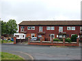
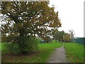
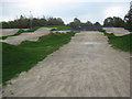
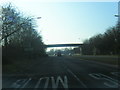
Photos of CW7 2GF


Area Information
Living in CW7 2GF means being part of a tightly knit residential cluster in the town of Winsford, Cheshire. This postcode covers 4.9 hectares and is home to 1,842 people, giving it a high population density of 1,134 people per square kilometre. Winsford itself, where this area lies, has a population of around 35,500 and a history stretching back to medieval times, with landmarks like St Chad’s Church and a market charter dating to 1280. The area is small but well-connected, with nearby railway stations and a range of local amenities. Daily life here is shaped by proximity to retail outlets, schools, and transport links, while the town’s historical roots add a sense of continuity. CW7 2GF is not a sprawling suburb but a compact, residential hub where community ties are likely strong. Its size means it’s ideal for those seeking a manageable, self-contained living environment without the sprawl of larger towns. The area’s character is defined by its balance of historical heritage and modern convenience, making it appealing to those who value both.
- Area Type
- Postcode
- Area Size
- 4.9 hectares
- Population
- 1842
- Population Density
- 1134 people/km²
The property market in CW7 2GF is characterised by a low home ownership rate of 22%, which implies that the majority of the housing stock is rented out rather than owner-occupied. The accommodation type is primarily houses, which may indicate a mix of larger family homes and rental properties. This suggests that the area is not a typical buyer’s market but rather one where rental demand is more prominent. Given the small size of the postcode—covering just 4.9 hectares—the immediate surroundings likely share similar characteristics, with limited new developments or high-end properties. For buyers, this could mean competition is limited, but the market may be more sensitive to external factors like interest rates or regional economic shifts. The predominance of houses also means that properties here are likely to be more spacious than in high-density areas, which could be a draw for families or those seeking more living space. However, the low ownership rate may also mean that properties are more frequently changing hands, affecting long-term investment potential.
House Prices in CW7 2GF
Showing 71 properties
| Address | Type | Beds | Baths | Last Sale Price | Last Sale Date | |
|---|---|---|---|---|---|---|
| 27 Heritage Rise, Winsford, CW7 2GF | Detached | 3 | 2 | £275,000 | Oct 2025 | |
| 8 Heritage Rise, Winsford, CW7 2GF | Detached | 4 | 2 | £310,000 | Jul 2024 | |
| 19 Heritage Rise, Winsford, CW7 2GF | house | - | - | £245,000 | Apr 2024 | |
| 18 Heritage Rise, Winsford, CW7 2GF | Detached | 3 | 1 | £247,500 | Nov 2023 | |
| 29 Heritage Rise, Winsford, CW7 2GF | Detached | 3 | 1 | £240,000 | Jul 2022 | |
| 28 Heritage Rise, Winsford, CW7 2GF | house | - | - | £180,000 | Mar 2022 | |
| 26 Heritage Rise, Winsford, CW7 2GF | Terraced | 2 | 1 | £132,000 | Jan 2022 | |
| 24 Heritage Rise, Winsford, CW7 2GF | Terraced | 2 | 2 | £136,000 | Aug 2021 | |
| 9 Heritage Rise, Winsford, CW7 2GF | Detached | - | - | £227,000 | Mar 2021 | |
| 17 Heritage Rise, Winsford, CW7 2GF | Detached | 4 | 3 | £238,000 | Nov 2020 |
Energy Efficiency in CW7 2GF
Residents of CW7 2GF have access to a range of local amenities within practical reach. The area is served by five retail outlets, including major names like Morrisons Daily, Tesco Winsford, and Spar, ensuring that everyday shopping needs are easily met. These stores provide convenience for groceries, household items, and other essentials, reducing the need for longer trips. The proximity to rail stations—Winsford, Hartford, and Cuddington—enhances mobility, allowing residents to travel to nearby towns or cities for work, leisure, or social activities. While the data does not mention parks or leisure facilities, the town of Winsford itself has historical landmarks and a market that contribute to a vibrant local culture. The combination of retail options and transport links means that daily life in CW7 2GF is both practical and connected to broader regional opportunities.
Amenities
Schools
Residents of CW7 2GF have access to two schools within practical reach. Woodford Lodge High School is a primary school, providing education for younger children, while Hebden Green Community School is a special school catering to students with specific educational needs. This mix of school types suggests a range of options for families, though the absence of secondary schools in the immediate area may require commuting for older students. The presence of a special school highlights the area’s commitment to inclusive education, which could be important for families with children who require tailored support. However, the data does not specify Ofsted ratings or academic performance, so prospective residents should investigate further to assess quality. For those prioritising proximity to schools, the availability of a primary and special school is a practical advantage, but the lack of a comprehensive secondary education network may influence long-term family planning.
| Rank | School | Type | Entry gender | Ages |
|---|
Explore more schools in this area
Go to Schools tabDemographics
The community in CW7 2GF is predominantly middle-aged, with a median age of 22 and the most common age range being adults aged 30–64. This suggests a mature, stable population, likely with established careers and families. Home ownership is relatively low at 22%, indicating that many residents are renters rather than property owners. The area’s accommodation is primarily houses, which may reflect a mix of family homes and rental properties. The predominant ethnic group is White, though the data does not provide further breakdowns of diversity. With a population density of 1,134 people per square kilometre, the area is moderately compact, which can foster a close-knit community but may also mean limited private space. The low home ownership rate could influence local dynamics, with a higher proportion of transient residents compared to owner-occupied areas. This demographic profile suggests a community that is neither young nor elderly, with a focus on stability and routine.
Household Size
Accommodation Type
Tenure
Ethnic Group
Religion
Household Composition
Age
Household Deprivation
NS-SEC
Explore more demographic insights in this area
Go to Demographics tabPlanning
Planning Constraints
- Flood RiskPremium
- Ramsar Wetland SitesPremium
- Area of Outstanding Natural BeautyPremium
- Protected Nature ReservePremium
- Protected WoodlandPremium